Craigdullyeart and Corsencon

Location and Access

Built alongside the River Nith, the village of New Cumnock is approximately 22km from Ayr and about the same distance from Kilmarnock on the A76 Dumfries road. Craigdullyeart Hill (NS 659 159) lies to the north-east of the village and is reached by turning off the A76 (just before the black and white chevron sign) onto the unclassified road at Pathhead / Mansefield about a kilometre from the roundabout at the western end of the village. Continue along this road past Mansefield Mains and Meikle Garclaugh and you will see Corsencon Hill directly ahead.

Just past the second farm there’s a junction and a give-way sign, go straight on here and you will see Craigdullyeart Hill to the left. The road at this point is quite narrow and winds up the valley between Corsencon and Craigdullyeart for about 2 kilometres. Once you reach the end of the tarmac at the top of the hill there is a gravel track which runs into a large spruce plantation to the north-east.

Off-road tracks unsuitable for wheelchair users. -4 places to stop on road and view glen. Turning space at top good for birds.

Quiet byways with some steep gradients.

Access Update

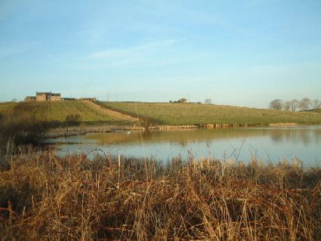
Following the completion of open-cast mining operations, all entry restrictions have been removed, the coal conveyor has been dismantled and the area landscaped.  Access to Glen Farm from Mansfield Road, New Cumnock is on a newly improved tarmac road which ends at a small parking area. After this the access road is currently in poor condition for driving but easily walkable. A wind turbine development is proposed for part of this area which may improve access in the future.

Mike Howes, February 2017

Birds

The area around Craigdullyeart is a mixture of farmland, heather moorland and conifer plantation, creating a mosaic of habitats which attracts a variety of different birds. Exploring the area on foot is obviously the best option, but if you are driving the following technique can be very useful. Go all the way to the top of the road (where the tarmac ends), spend some time scanning along the drystane dykes which run along the bottom of Corsencon on the left, then slowly drive back down using your car as a mobile hide. This allows good close views of birds on either side of the road and you can stop at a number of vantage points which look out over the glen and surrounding countryside. At the top of the glen where the large Sitka Spruce plantation begins, Skylark, Reed Bunting and Lesser Redpoll can be found, (watch out for Skylarks perching on the fire-beaters by the side of the road), this is also a good area to look for Crossbill. As you come back down the glen, the young plantations on either side of the road are excellent for Stonechat, Whinchat and Meadow Pipit. There is a Black Grouse lek on the lower slope of Corsencon which can be observed from near the top of the road, there are sometimes up to 6 birds here during the breeding season. At other times Black Grouse can be seen amongst the small trees in the plantations or perched up on the drystane dykes which criss-cross the site. Short-eared Owl also breed in the glen, but only seem to do so in years when Field Voles are abundant. Kestrel can always be seen, Sparrowhawk have nested in one of the plantations and there is usually a Buzzard or two over the hill. Curlew are particularly noticeable flying up and down the glen during the breeding season. The lower part of the site where the farmland begins is worth a look for species such as Yellowhammer, Linnet and Bullfinch. In summer the area holds plenty of Warblers and Hirundines and in winter the fields can be covered in Thrushes and Starlings. Early summer is probably the best time for a visit, although there is a fair chance that migrants could be located on Corsencon at the appropriate times during spring and autumn passage.

Other Information

By following the unclassified road down past Merkland Farm and the front of Corsencon, excellent views can be had over the floodplain of the River Nith where there are often flocks of geese in the winter. To do this, turn left at the road junction on your way back down the glen.

New Cumnock is reasonably well served by public transport, regular buses run from Cumnock and there is a frequent train service from Glasgow / Kilmarnock. The main bus service is the No 43 which leaves The Tanyard in Cumnock twice an hour. Trains from Glasgow and Kilmarnock (or stations in between) are either Carlisle or Newcastle services and run approximately every hour although the times do vary throughout the day.   Craigdullyeart and the other nearby New Cumnock sites would be well suited for cycling around as the back roads around the village are fairly quiet. Cycling birders would however be well advised to avoid the A76 outside the boundaries of the village as this is one of the busiest roads in this part of the county.

Trabboch Loch and Stair

Location and Access

Trabboch (NS 438 220) and Stair (NS 438 235) are two tiny communities north of the village of Coylton and some 10 km east of Ayr. From Ayr, pass through Coylton on A70 heading east and take B730 north just after passing Coalhall and under a railway bridge. Trabboch Loch lies in a hollow on the west of the road. Park with consideration near the former Trabboch village school, now a community centre, and approach the loch on foot along the track to Drumclow farm which bisects the loch and surrounding marshland.

Stair Inn, a former coaching inn, lies in a hollow beside the bridge over the River Ayr and is surrounded by tall, mature, broadleaf trees which are alive with song, especially after a convivial visit by the birdwatcher. Excellent views of the river can be had from the bridge but have a care for traffic, albeit being light. The network of minor roads in the area provide excellent cycling but the nearest bus route is at least 2 km distant on the A70. The River Ayr Way passes through Stair as it comes along the Ayr Gorge.

Trabboch Loch: Scan from car park, single-track to farm is narrow, steep, rough and unsurfaced. Stair: Scan from car park (limited viewing).

Both sites on good network of byways linking through to Ayr and Cumnock, but beware of opencast mining traffic near Cumnock.

Birds

Trabboch Loch is an East Ayrshire Listed Wildlife Site. The mature stand of trees around the Stair Inn contains a rich variety of woodland species and the river can be scanned for Dipper, Wagtails and Kingfisher.

The small lochs have been very productive over the years including such birds as Smew, Wood Sandpiper, Long-tailed Duck and Common Crane. While these lochs are relative small they are well worth a visit if you are in the area as anything could turn up. They can be easily scanned from the track, though watch out for other road users.

It is probably the best site in Ayrshire for wintering Pochard with flocks of up to 40 birds. Waterfowl predominate especially in winter. Tufted Duck, Mallard and Little Grebe are common, though Scaup, Wigeon and Gadwall are regular winter visitors. Water Rail inhabits the reed beds and can regularly be heard. Winter flocks of finches and thrushes can be seen feeding in the fields behind the parking space.

In summer the dense undergrowth and nearby woodland play host to a number of passerines including Sedge Warbler, Blackcap, Willow Warbler, Chiffchaff and Reed Bunting. In autumn it is well worth checking the loch sides for waders.

A ‘scope is not essential for this site though binoculars would be very useful.

Dean Castle Country Park

Location and Access

Dean Castle Country Park is located at the north end of Kilmarnock (NS 436 95). The park is open from dawn till dusk and is free of charge. If you are unfamiliar with Kilmarnock’s one way system, the simplest way to get to the park is to by-pass the town centre completely! This can be done by heading north for Glasgow on the A77 until you reach the junction at the Meiklewood Interchange on the outskirts of the town. This is sign-posted ‘Kilmarnock B7038’- there is also a brown tourist sign which says ‘Dean Castle Country Park – 2 miles’. This junction is the fourth Kilmarnock turn-off if you are travelling from Ayr or the second one if you are travelling from Irvine via the Bellfield Interchange. Heading south from Glasgow take the first available turn-off for Kilmarnock (just after Fenwick). From this junction drive down the B7038 past the new housing estate at Southcraig to the roundabout next to the Howard Park Hotel / BP garage. Bear left at this roundabout and continue on down Glasgow Road. Take the fifth turning on the left onto Dean Road. The main entrance to the Country Park is halfway along this road. It takes about 15 minutes to walk to the park from the bus or railway stations in Kilmarnock town centre and the No.4 bus service to and from Glasgow passes right by Dean Road.

The Country Park is a compact 200 acre site, comprising of a variety of habitats, including mixed woodland, conifer plantation, semi-natural oak woodland, areas of scrub and open pasture. The Fenwick and the Craufurdland Waters run through the site and merge to form the Kilmarnock Water near the park boundary. A network of trails allows easy access to all areas of the park and there are plenty of quiet corners to explore.

< Disabled parking. Network of metalled and unsurfaced paths, some rough and steep. Plan of tracks available. Contact Ranger Service for further details (see end).

Easy ride from the town centre, bus & rail stations, and National Cycle Route N73.

Birds

Despite the park’s urban location it a attracts a good variety of birds and is well worth a visit in spring and early summer, although there is plenty of interest at other times of the year as well. The park is surrounded on three sides by houses, so birds usually associated with gardens can be readily seen, these include Collared Dove, Song Thrush, Wren, Blackbird, Dunnock, Robin, House Sparrow and Starling. To the northeast the park borders onto dairy farmland where Yellowhammer, Goldfinch, Rook and Black-headed Gull can be seen throughout the year. In the autumn and winter months, large flocks of Fieldfares and Redwings frequent this area, along with smaller numbers of Meadow Pipits and Pied Wagtails.

Sparrowhawk and Tawny Owl are resident breeding species in the woodlands, both are a common sight around the area in front of the castle. Kestrel and Buzzard breed nearby and can often be seen hunting over the open fields of the park. Many of the more common Ayrshire species are also resident in the woodlands. Coal, Blue, Great and Long-tailed Tits are a familiar sight, Treecreepers and Goldcrests are also regularly seen. There are good numbers of Chaffinches, Greenfinches, Bullfinches and Siskins as well as one or two pairs of Great Spotted Woodpecker and Mistle Thrush. Dippers and Grey Wagtails frequent the rivers and Kingfishers have been seen now and again at some of the quieter pools. During the summer, Willow Warblers, Chiffchaffs and Blackcaps breed throughout the park and there is a small area of semi-natural Oak woodland where Wood Warbler has been heard on occasion. Spotted Flycatchers, Swifts, Swallows and House Martins also make a welcome addition to the bird-life found in the park at this time of year. An old flooded quarry is the only significant area of still water in the park, Mallard and Wigeon are the two duck species seen most often amongst the exotic wildfowl, although other species such as Goosander and Goldeneye turn up from time to time. Grey Herons nest nearby and there are often Lesser Black-backed Gulls and Cormorants on the small island. Early morning visits are best as the park can become very busy, particularly at the weekends and during the holidays, although there are some areas where very few people visit at any time! Trail leaflets are available from the Visitor Centre or the Ranger Office next to the castle.

Additional Information

The castle which gives is name to the country park consists of a 14th Century keep and a 15th Century palace, both of which can be visited on one of the free public tours which run each afternoon. There is also a visitor centre with a well stocked tearoom and an interpretation area where you can find out more about the social and natural history of the park. During the summer months, the countryside ranger service runs a varied programme of events. More details of these events and further information about the country park can be obtained from:

East Ayrshire Countryside Ranger Service,
Dean Castle Country Park,
Dean Road,
Kilmarnock
KA3 1XB.
Phone:
01563 522702
Email:
rangers@east-ayrshire.gov.uk

Cairn Table

Location and Access

Muirkirk is a small town which lies 24 miles inland from Ayr close to the Lanarkshire border. Cairn Table is the highest of the hills which dominate the moorland landscape to the south of Muirkirk, rising 593m above sea level. The hill takes its name from the two large prehistoric cairns which stand on the summit. There is also a more modern cairn which serves as a memorial to local people who died in the First World War.

The hill is accessed by a well used track (known locally as the March Dyke) up the north-west slope which starts near the public car park at Kames (NS 697 265). Access to the car park is on Furnace Road, just off the A70 which runs through the middle of the town. If you are driving into Muirkirk from the west, take a right turn just before the Coachouse Inn (approximately 200m before the traffic lights), watch for the sign which says “camp site and golf course”. Follow the road round past the industrial estate and the car park is on your left just before the sandstone school building. There is an information board in the car park which has the route up to the hill detailed on it. From the start of the walk it is 4km to the summit using the direct path which should take between an hour and 90 minutes, depending on how fit you are and how often you stop to look at the wildlife! From the summit you can follow other paths toward the Gappell Water and the track from Muirkirk to Sanquhar, then head back to the car park via Tibbie’s Brig. This gives a total walk of 10km.

The view from the summit of Cairn Table is superb, giving a panoramic view of much of south and central Scotland (and beyond), as shown by the indicator on the right.

These are rough hill tracks, steep in places. 00 – 400mm wide access gate at start (cattle barrier?).

Approach along A70 requires great care.

Birds

The area of open moorland around Muirkirk is one of the most significant upland heath sites in Southern Scotland and has been designated a Site of Special Scientific Interest and a Special Protection Area because of its assemblage of breeding birds. Much of the land is managed as grouse moor which helps to conserve many of the plant and animal species associated with this particular type of habitat. Ling heather, purple moor grass and Sphagnum mosses form a mosaic of vegetation which is attractive to a wide range of invertebrates, mammals and birds.

Hen Harrier, Merlin and Short-eared Owl breed in the area around Cairn Table and with a bit of luck all three species can be seen on a walk up the hill. Kestrel and Buzzard are also usually present. The site is important for breeding Golden Plover and other waders such as Curlew, Snipe, Redshank and Dunlin. Stonechat, Twite and Skylark breed as well and can typically be seen close to the path. Spring and early summer are the best times to visit.

Other Nearby Sites

There is a selection of alternative walking routes around this area, all of these are detailed on the information board in the car park at Kames and also in a leaflet of Muirkirk walks which is available locally, or visit the Ayrshire Paths website. Particularly energetic birders could tackle the Sanquhar Road Walk, a 28 km trail which follows an old drove road across the moor, you would however need to arrange a pick up at the other side or walk all the way back again! The whole area around Muirkirk is rich in history, from Mesolithic and Neolithic remains, to Covenanting memorials and more recent industrial heritage sites, so wherever you choose to walk you are sure to see something of interest.

Public Transport

A regular bus service operated by Stagecoach runs between Cumnock and Muirkirk. The X76 leaves the bus station in Cumnock at 45 minutes past each hour and makes the return journey at 15 minutes past each hour during the day. Early morning and evening buses are less regular so it’s best to check with Stagecoach for the most up to date information. Connections to Cumnock are available from Kilmarnock and Ayr bus stations.

Ness Glen

Location and Access

The outflow river from Loch Doon plunges down Ness Glen at NS 476 013 and onwards to Bogton Loch. The Glen is a Site of Special Scientific Interest. Its west bank lies mainly on private land but the east bank is readily accessible on foot. Other surrounding ground is also good birding.

From the A713 Dalmellington-Castle Douglas road, 2km SE of Dalmellington, take the byway to Loch Doon and in 4km, over the dam, there isa small car park and visitors’ centre (with toilets). The upper reaches of the gorge and the outflow can be scanned from here. There is good birding all along this stretch of road and the outing can start from a car park where the byway leaves A713. About 1 km short of the dam, however, a walking track leads down the east side of the glen, providing excellent birding and leading eventually right through to Bellsbank/Dalmellington. The continuation of this track east of the byway is also a right of way.

There is a regular bus service along the A713 and the byway is ideal for cycling, leading as it does along the shores of Loch Doon and onwards into the Galloway Forest and to national and local cycle networks.

Rough unsurfaced woodland tracks, steep and narrow in places.

The byway is very suitable for cycling.

Birds

The gorge has a good mixture of broadleaf and relict pine wood and the pleasantly animated stream is attractive to birds. Among the interesting diversity of species that can be expected are Goosander, Buzzard, Cuckoo, Tree Pipit, Redstart, Wood Warbler, Pied Flycatcher, Spotted Flycatcher and Crossbill.

Loch Doon

Location and Access

Loch Doon is a major reservoir for Ayrshire and is a Site of Special Scientific Interest because of the Arctic Charr which breed there. It is 9km long and set high in the Ayrshire part of the Galloway hills. The beautiful vistas of moorland and forest attract the outdoor enthusiasts – walkers, cyclists, fishers, picnickers and, of course, birdwatchers. The surround hills provide some of the best hill walking in Ayrshire and much of the land is managed by Forest Enterprise and is accessible to the public via a network of forest trails.

From the A713 Dalmellington-Castle Douglas road, 2 km SE of Dalmellington,take the byway signed to Loch Doon. Buses pass this road end regularly. It is a long walk in along the byway but excellent cycling. After the initial climb to the north end of the loch, the byway runs attractively along the west bank past grassland, scrub and moorland with patches of woodland. There are many possible stopping places and a number of tracks onto the moor. Beyond the public roadway, forest tracks lead on for walkers and cyclists – one is a signed cycle route through the hills to Barr and Straiton in South Ayrshire.

Narrow country road. View loch and surrounds from car parks or park by verge. No safe refuges for wheelchair users to avoid passing traffic.

Quiet, level cycling.

Birds

The reservoir’s stony shore has limited life, though Grey and Pied Wagtail and Common Sandpiper are regulars. The waters may have Goosander, Merganser, Goldeneye, Tufted and other duck. On the moors are Meadow Pipit, Stonechat, Grasshopper Warbler, Wheatear and Skylark. Peregrine, Buzzard and Raven may be overhead and a glimpse of hunting Merlin may be had. There is an easily accessible track onto the lower slopes of Craiglee Hill, just behind the remains of Loch Doon Castle (NS 484 951) where all four of these species can be seen regularly. Early-rise birdwatchers should look out for the Blackcock leks in season. The pine and mixed woodlands have appropriate species, including Goldcrest and Crossbill.

Irvine Valley Trail

Location and Access

This is a core trail along the valley of the River Irvine with associated local walks. Links the towns of Hurlford, Galston, Newmilns, and Darvel/Priestland along A71 east of Kilmarnock. The trail was established under the auspices of The Irvine ValleyRegeneration Partnership. A leaflet is available from tourist information centres; or visit the Ayrshire Paths website.

Birds

The various sections of trail and the several local walks access a wide range of typical managed rural environments: river bank, wetland, woodland, farmland and town green spaces. A good range of the species associated with these habitats can be expected. Three areas of particular ornithological merit are described in their own location reports: East Holmes Marsh and Ladyton Loch, Big Wood and Loudoun Hill.

Access along the A71 is not recommended. Instead, approach via byways to the north.

A71 not advised, but good byway network along the valley, especially the north side.

More Information

Each town has a strong historic heritage. Cultural and environmental interests can be combined. For more details contact:

Irvine Valley Regeneration Partnership
Town House
48-50 Main Street
Newmilns
KA16 9DE
Phone:
01560 22 966

Woodroad Park, Cumnock

Location and Access

Woodroad Park (NS 565 204) is a municipal recreation area which lies at the north end of Cumnock, the second largest town in East Ayrshire. The entrance to the park is off the B7083 Cumnock – Auchinleck road and is just two minutes from the bus station and town centre facilities. An extensive network of footpaths takes in all of the main areas of the park and a public right of way links the park to nearby farmland.

Surfaced car park. Some tracks accessible – 4 steps at end prevent circular route near tennis courts being completed, locked gate at start of track to river.

Two minute ride from bus station and town centre.

Birds

The main interest from a birding point of view is the semi-natural ancient woodland which makes up a substantial part of the site. Templeton Wood stretches along the north-west edge of the park and contains a good variety of tree species including mature Oak and coppiced Hazel. The woods are managed for conservation value by East Ayrshire Woodlands. Resident bird species which can be seen here all year round include Great Spotted Woodpecker, Sparrowhawk, Tawny Owl, Treecreeper, Jay and Bullfinch. As with other similar sites, the best time to visit is spring and early summer when the woodland attracts a range of migrants such as Redstart, Willow Warbler, Chiffchaff, Blackcap and Spotted Flycatcher. Wood Warbler and Tree Pipit are also possibilities. Swift nest on the railway viaduct and Swallow, House Martin and Sand Martins can all be seen in the park. In autumn and winter, mixed flocks of Blue, Coal, Great and Long-tailed Tit can be found foraging through the woods along with Treecreeper and Goldcrest. Remnants of ancient woodland also line the banks of the Lugar Water at the north-east end of the park and a footbridge leads across to the opposite bank of the river. As well as these wooded areas the park has sections of open grassland where typical “park birds”, such as Song Thrush, Blackbird, Pied Wagtail, Chaffinch and House Sparrow can be found. The river usually has at least one pair of Dipper, which can often be seen from either of the two bridges. Grey Wagtail and Grey Heron are also present and Kingfisher is seen occasionally. To extend your exploration of the park (and your bird list) you can follow the public right of way which goes up past the caravan site and under the railway viaduct to Templand Mains. This path then heads off uphill towards Rigg Road, passing through farmland which is fairly typical of the area. Breeding species found in the fields here include Oystercatcher, Lapwing, Skylark and Meadow Pipit, while Greenfinch and Yellowhammer can be seen along the hedgerows.

Other Information

In 2008 the local community started an ambitious programme of regeneration and enhancements to the Park.

The nearby Baird Institute Museum on Lugar Street is worth a look if you are interested in the history of the local area. The museum is open on Monday, Tuesday, Thursday and Friday from 10am – 1pm and 1.30pm – 4.30pm. Just around the corner is Stevenson’s Bakery which has plenty of good things to eat and there is a profusion of pubs, cafes and shops within a few minutes walking distance.

Public Transport

There are frequent bus services to and from Cumnock. The town’s bus station in The Tanyard is the main transfer point for services to outlying areas such as Muirkirk and New Cumnock. The two main buses which run from Ayr are the 43 and 46, the 43 goes via Mauchline and the 46 via Ochiltree. These leave Ayr bus station every hour, the 43 at half past and the 46 at five to.

Travelling from Kilmarnock you need to catch the X76 which leaves the bus station every hour on the hour from 10am onwards (there is one earlier bus at 8.15am). There is a handy bus stop right at the entrance to Woodroad Park, but if you miss it the bus station is only a two minute walk away!

Knockentiber to Kilmarnock Railway

Location and Access Details

The Knockentiber to Springside section comprises part of the former railway line running between Kilmarnock and Irvine and has been converted into a footpath/cycle path/farm access path following dismantling.

Access the line from the north side of Knockentiber village on the B751 at OS grid reference NS 400 96 or the unclassified road to Kilmarnock at NS 404 95. Access at the north end of Springside on Overton Road (to Warwickdale) at NS 69 91 or via the farm track (which crosses a stubble field in winter) at NS 69 93 which will direct you onto the line approximately 0.5 km east of the village. While it is a 4 km walk from end to end, the areas of greatest interest are actually around the villages. Park in either village and walk the path in either direction. It is an ideal site to cover by bicycle. Alternatively, an unclassified road from Knockentiber to the Cunninghamhead area crosses the line approximately half way where there is space for roadside parking on the left after the bridge.

Park at side of road (not ideal). Long ramp down to cycle track at Knockentiber, gentle grade at Springside.

Part of National Cycle Route N73, Irvine to Kilmarnock. The track between Knockentiber and Kilmarnock has been recently surfaced.

Habitat

The disused railway line is a rich, semi-natural, linear habitat of overgrown hedgerow, scrub and rough grassland verges traversing some fairly interesting farmland. The land is drained by the Garrier and Woodhill Burns. Smaller areas include a juncus rush marsh, bramble-strewn wasteland, nettle beds, bricks and mortar and a marshy cutting on the line (before recently introduced drainage). However, recent tarmac “improvements” at the Knockentiber end have damaged much of the habitat, although hopefully within time the area will recover. Fly-tipping, burnt-out cars and illegal shooting are all a problem here from time to time.

Birdwatching, Timing and Points of Interest

Free from busy traffic, the line offers a good vantage point to observe typical farmland birds of Ayrshire and to connect with the locally rare Tree Sparrow. The density of breeding warblers and buntings is particularly high for the area. Average figures for the 1990’s: Willow Warbler (26 territories and upwards of 5 singing males during spring passage), Whitethroat (12 territories), Sedge Warbler (12), Grasshopper Warbler (3-4), Blackcap (2), Reed Bunting (4-5), Yellowhammer (14). Early mornings in May and June are the most productive months in terms of diversity and birdsong. September to December for passage, winter and more unusual species. Late winter is rather quiet. A total of 83 species has been recorded since 1991.

The following points along the line are of particular interest:

  1. Heading west from the Knockentiber end, the bridge over Woodhill Burn at NS 403 95 provides a good watchpoint for breeding warblers, Bullfinch, Long-tailed Tit, water birds on the burn below and perhaps Sparrowhawk and Buzzard over Bailiehill Mount to the north.
  2. The area around the juncus rush marsh at NS 97398 is excellent for warblers with reeling Grasshopper Warbler, Reed Buntings, Linnet, Goldfinch, Greenfinch and occasionally a single pair of Tree Sparrows breeding here. Grey Herons are regular here, Kingfisher can occur in the large ditch in autumn and Snipe in winter. Breeding Skylarks occur in the field of unimproved grassland on the other side of the line.
  3. The cutting at NS 92397 is a good area for all the warbler species as well as Goldfinch, Song Thrush, and the common woodland birds. Snipe are usually flushed here soon after dawn during hard weather.
  4. The bridge crossing the Garrier Burn at NS 90398 provides Sand Martin, Grey Heron and Mallard during the breeding season, large gatherings of Scandinavian thrushes in autumn and large winter parties of Magpies. Moving on, the fields on the right may have a few Wheatears during the passage periods.
  5. The line then crosses the Garrier Burn twice at NS 81397 and NS 78395 and this area holds good numbers of breeding Yellowhammers and Grey Partridges and usually a pair of Curlews. The large, mature beeches on the right are an important area for hole-nesting species including Tree Sparrow, Stock Dove, Jackdaw and tits.
  6. The gas works at NS 76 93 usually has single pairs of breeding Oystercatcher and Pied Wagtail and the surrounding scrub can hold a winter roost of Tree Sparrows.
  7. The beeches around the farm track at NS 74 94 have breeding Tree Sparrows and if stubble is present over the winter months the area should be checked for mixed feeding flocks of sparrows, buntings and finches. Large numbers of Collared Doves may build up here, e.g. 110 in October 1996.

Species Calendar

All Year:
Many of the breeding residents. Grey Heron, Sparrowhawk, Lapwing (occasional), gulls, Rook.
Spring:
Warbler/hirundine passage, Meadow Pipit, Wheatear, Chiffchaff.
Breeding:
Mallard, Kestrel, Grey Partridge, Quail (suspected 1997), Pheasant, Moorhen, Oystercatcher, Curlew, Stock Dove, Wood Pigeon, Collared Dove, Skylark, Sand Martin, Pied Wagtail, Wren, Dunnock, Robin, Song Thrush, Blackbird, Blackcap, Whitethroat, Sedge Warbler, Grasshopper Warbler, Willow Warbler, Great Tit, Blue Tit, Long-tailed Tit, Magpie, Jackdaw, Carrion Crow, Starling, House Sparrow, Tree Sparrow, Chaffinch, Linnet, Goldfinch, Greenfinch, Bullfinch, Reed Bunting, Yellowhammer.
Summer:
Breeding species plus Swift, Swallow and House Martin overhead.
Autumn:
Skylark and Meadow Pipit passage, thrush passage, Goldfinch flocks, Wheatear, Spotted Flycatcher, Larid flocks.
Winter:
Snipe, Grey Wagtail, Redwing, Fieldfare, Goldcrest, Coal Tit, Long-tailed Tit (flocks), Siskin, Redpoll (occasional), mixed flocks of Tree Sparrow (inc. roost), finches and buntings, Corvid flocks.
Unusual or scarce:
Cormorant (overhead), Whooper Swan, Greylag Goose, Teal, Buzzard, Peregrine, Merlin, Quail, Water Rail, Golden Plover, Cuckoo, Kingfisher, Great Spotted Woodpecker, Tree Pipit, Whinchat, Mistle Thrush, Garden Warbler, Treecreeper, Hooded Crow, Brambling.

Other Wildlife

Fifteen species of butterfly have been recorded including Grayling, Orange Tip, Small Heath and Clouded Yellow. Black Darter and Common Darter dragonflies are abundant (August to October) at the Knockentiber end. It is also interesting for flowering plants and Roe Deer at the Knockentiber end. Surely this green corridor for wildlife should have some sort of conservation status as it deserves to be protected from further degredation.

Big Wood, Galston

Location and Access

The aptly named Big Wood (NS 515 75), known locally as “The Bluebell Planting” is about 24 km from Ayr just east of Galston on the A71 next to Loudoun Golf Course. The wood is privately owned, but is managed by East Ayrshire Woodlands who have a 25 year management agreement allowing public access. Parking is available in the lay-by at Hags Bridge (NS 517 71) off the A71. A well defined track (which is also a public Right Of Way) starts just beside the lay-by and runs up through the site to Woodhead Farm. Walking up the track gives excellent views of the varied habitat and of some of the magnificent specimen trees in the wood, there is also plenty of scope to do a little exploring off the beaten track, but please observe any “private property” signs you come across.

A productive circular walk can be had by turning right when you reach Woodhead Farm and following the unclassified road back down to the A71. If you choose to do this please be aware of the following information! Assuming that you are driving and have parked in the lay-by at Hag Bridge you will naturally want to get back to your vehicle: this requires caution and nifty footwork. When you get back to the main road you have to cross over to reach the pavement on the other side, this is not too bad as the road here is close to a 0 MPH zone and the traffic is relatively slow. However, at the point where you cross back to reach the lay-by you could be forgiven for thinking that you have ended up on a Formula One race track by mistake! Appropriate caution should definitely be exercised here unless you fancy being known as “The Flat Birder”. Walking on the verge facing oncoming traffic is only for maniacs and those tired of life!

Unsurfaced muddy tracks with cobbles, steep section up from road.

Access along the A71 is not recommended. Instead, approach via byways to the north from Newmilns or Kilmarnock.

Birds

Big Wood is the site of an ancient woodland which has been extensively managed in the past. As part of Loudoun Castle Estate the woods were replanted in the late 19th and early 20th Century as a designed landscape, this accounts for many of the mature specimen trees which are in the woods today. The woods are largely comprised of Oak, Beech, Elm and Ash with a good under-storey of Hazel, Elder, Rowan and Holly. In spring the wood is carpeted with Bluebells, making this a particularly attractive time to visit, there is also a great variety of plants and wildflowers to be found right through the summer.

A spring or early summer visit is also likely to be the most rewarding in terms of bird life. Spotted Flycatcher, Blackcap, Willow Warbler, Chiffchaff and Garden Warbler can all be found and Wood Warbler is a strong possibility. Species which can be seen all year round include: Jay, Great Spotted Woodpecker, Sparrowhawk, Treecreeper, Long-tailed Tit, Song Thrush, Mistle Thrush and Bullfinch. Other birds which the habitat seems right for are Woodcock and Brambling so an autumn or winter visit to the site might also be worthwhile. The surrounding fields which can be viewed from some points on the track and also from the road next to Woodhead Farm have breeding Oystercatcher and Lapwing as well as lots of Pheasant and Rook. The hedgerows around the site are all fairly intact and are quite species rich so would be good places to look for Yellowhammer, Greenfinch and House Sparrow.

Additionally, if you choose to walk down the road from the farm there is a small area of woodland on the left, just behind Newmilns fire station which has recently been planted up with native trees. There is open access to this area and a visit might just add a few more birds to your day list. To introduce even more variety to the proceedings, cross over the A71 and have a look along the banks of the River Irvine. There is a Sand Martin colony nearby and summer also brings Common Sandpiper to the exposed shingle spits in the river. Grey Wagtail, Dipper and Kingfisher as well as the occasional Otter have all been seen on this stretch of The Irvine.

Additional Information

A visit to Big Wood could be combined with other Irvine Valley sites such as Loudoun Hill and East Holmes Marsh making an interesting day’s birding in a variety of habitats. Nearby the town of Galston offers a reasonable choice of places for a bite to eat, try The Wee Train at 22 Wallace Street for a bar lunch or the Balmoral Knitwear Tea-room on Polwarth Street for a quiet cuppa and a cake. Also worthy of a mention for those with an interest in rocks, fossils and shiny things is the Lotus Crystals shop at 1 Polwarth Street, it’s worth going in just to have a look at the incredible geological displays!

Happily the Galston area is on a bus route with a regular service for anyone not keen on driving to bird watching sites. Buses to Galston, Newmilns and Darvel run every 20 minutes from Kilmarnock bus station. Services 1 and 2 both go as far as Galston, while Service 2 carries on to Newmilns and Darvel.

There are is a slightly reduced service on a Sunday, for further details contact Stagecoach on 01563 525192 or Traveline on 0870 608 2068. For Big Wood, get off near the Co-op supermarket and walk east along past the golf course. Cycling is a good way of getting around the Irvine Valley sites but the A71 is definitely best avoided, take an OS map and stick to the network of back roads instead!