Location and Access
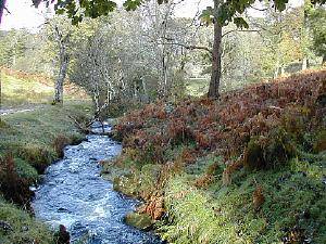
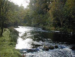
 The outflow river from Loch Doon plunges down Ness Glen at NS 476 013 and onwards to Bogton Loch. The Glen is a Site of Special Scientific Interest. Its west bank lies mainly on private land but the east bank is readily accessible on foot. Other surrounding ground is also good birding.


From the A713 Dalmellington-Castle Douglas road, 2km SE of Dalmellington, take the byway to Loch Doon and in 4km, over the dam, there isa small car park and visitors’ centre (with toilets). The upper reaches of the gorge and the outflow can be scanned from here. There is good birding all along this stretch of road and the outing can start from a car park where the byway leaves A713. About 1 km short of the dam, however, a walking track leads down the east side of the glen, providing excellent birding and leading eventually right through to Bellsbank/Dalmellington. The continuation of this track east of the byway is also a right of way.
There is a regular bus service along the A713 and the byway is ideal for cycling, leading as it does along the shores of Loch Doon and onwards into the Galloway Forest and to national and local cycle networks.
![]() Rough unsurfaced woodland tracks, steep and narrow in places.
Rough unsurfaced woodland tracks, steep and narrow in places.
![]() The byway is very suitable for cycling.
The byway is very suitable for cycling.
Birds
The gorge has a good mixture of broadleaf and relict pine wood and the pleasantly animated stream is attractive to birds. Among the interesting diversity of species that can be expected are Goosander, Buzzard, Cuckoo, Tree Pipit, Redstart, Wood Warbler, Pied Flycatcher, Spotted Flycatcher and Crossbill.