Location and Access
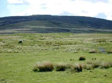
 Muirkirk is a small town which lies 24 miles inland from Ayr close to the Lanarkshire border. Cairn Table is the highest of the hills which dominate the moorland landscape to the south of Muirkirk, rising 593m above sea level. The hill takes its name from the two large prehistoric cairns which stand on the summit. There is also a more modern cairn which serves as a memorial to local people who died in the First World War.
The hill is accessed by a well used track (known locally as the March Dyke) up the north-west slope which starts near the public car park at Kames (NS 697 265). Access to the car park is on Furnace Road, just off the A70 which runs through the middle of the town. If you are driving into Muirkirk from the west, take a right turn just before the Coachouse Inn (approximately 200m before the traffic lights), watch for the sign which says “camp site and golf course”. Follow the road round past the industrial estate and the car park is on your left just before the sandstone school building. There is an information board in the car park which has the route up to the hill detailed on it. From the start of the walk it is 4km to the summit using the direct path which should take between an hour and 90 minutes, depending on how fit you are and how often you stop to look at the wildlife! From the summit you can follow other paths toward the Gappell Water and the track from Muirkirk to Sanquhar, then head back to the car park via Tibbie’s Brig. This gives a total walk of 10km.

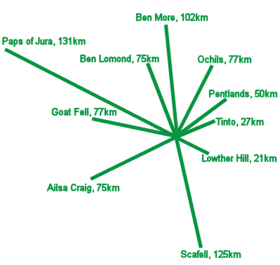
The view from the summit of Cairn Table is superb, giving a panoramic view of much of south and central Scotland (and beyond), as shown by the indicator on the right.
![]() These are rough hill tracks, steep in places. 00 – 400mm wide access gate at start (cattle barrier?).
These are rough hill tracks, steep in places. 00 – 400mm wide access gate at start (cattle barrier?).
![]() Approach along A70 requires great care.
Approach along A70 requires great care.
Birds
The area of open moorland around Muirkirk is one of the most significant upland heath sites in Southern Scotland and has been designated a Site of Special Scientific Interest and a Special Protection Area because of its assemblage of breeding birds. Much of the land is managed as grouse moor which helps to conserve many of the plant and animal species associated with this particular type of habitat. Ling heather, purple moor grass and Sphagnum mosses form a mosaic of vegetation which is attractive to a wide range of invertebrates, mammals and birds.
Hen Harrier, Merlin and Short-eared Owl breed in the area around Cairn Table and with a bit of luck all three species can be seen on a walk up the hill. Kestrel and Buzzard are also usually present. The site is important for breeding Golden Plover and other waders such as Curlew, Snipe, Redshank and Dunlin. Stonechat, Twite and Skylark breed as well and can typically be seen close to the path. Spring and early summer are the best times to visit.
Other Nearby Sites
There is a selection of alternative walking routes around this area, all of these are detailed on the information board in the car park at Kames and also in a leaflet of Muirkirk walks which is available locally, or visit the Ayrshire Paths website. Particularly energetic birders could tackle the Sanquhar Road Walk, a 28 km trail which follows an old drove road across the moor, you would however need to arrange a pick up at the other side or walk all the way back again! The whole area around Muirkirk is rich in history, from Mesolithic and Neolithic remains, to Covenanting memorials and more recent industrial heritage sites, so wherever you choose to walk you are sure to see something of interest.
Public Transport
A regular bus service operated by Stagecoach runs between Cumnock and Muirkirk. The X76 leaves the bus station in Cumnock at 45 minutes past each hour and makes the return journey at 15 minutes past each hour during the day. Early morning and evening buses are less regular so it’s best to check with Stagecoach for the most up to date information. Connections to Cumnock are available from Kilmarnock and Ayr bus stations.