Location and Access
![]() Eglinton Country Park is situated just off the A78 Ayr to Greenock road, on the outskirts of the town of Irvine.
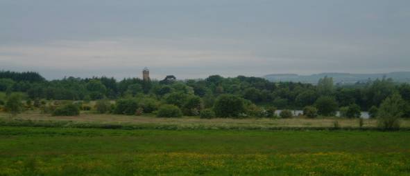
Eglinton Country Park is situated just off the A78 Ayr to Greenock road, on the outskirts of the town of Irvine.
Eglinton Country Park is 1000 acres, created around the ruins and the estate of Eglinton Castle, it includes formal gardens, woodland, river, loch and Visitor Centre. A ranger service provides an interpretative service and guided walks, there are also self-guided trails and facilities for cycling, horse riding and angling.
 The Visitor Centre includes a history exhibition and a gift shop, Tearoom, picnic areas and children’s play area. Wheelchair access and facilities for disabled visitors. A Guided Walks and Events Programme is available from Easter. The mixture of river, loch, agricultural land and woodland attracts a variety of birds.
![]() Disabled parking. Extensive network of metalled and un-metalled paths. Rough steep tracks through some woods.
Disabled parking. Extensive network of metalled and un-metalled paths. Rough steep tracks through some woods.
![]() On network of local cycle ways connecting with National Route 7. This forms part of the Irvine Circular Trail.
On network of local cycle ways connecting with National Route 7. This forms part of the Irvine Circular Trail.
Birds
- Resident breeding species include:
- finches, tits, thrush, Pheasant, Grey Partridge, Tawny Owl, Kestrel, Sparrowhawk, Great Spotted Woodpecker, Skylark, Yellowhammer.
- Resident (but non-breeding):
- Buzzard.
- Winter visitors:
- Fieldfares, Redwings, occasional Waxwings and sightings of Hen Harrier and Kingfisher.
- Wildfowl include:
- Goldeneye, Wigeon, Tufted and Mallard ducks with Whooper Swans and geese on passage. Also Woodcock, Snipe, Curlew and Lapwing.
- Summer migrants:
- Swifts, Swallows and Martins; Willow, Sedge and Grasshopper Warblers, Blackcap and Chiffchaff.
Usual sightings of various songbirds, water fowl and birds of prey, can be interspersed with the exotic (White Stork, Black Swan) and the unbelievable (a Flamingo!).
Additional Information
Further information may be had from:
The Ranger ServiceThe Visitor Centre
Eglinton Country Park
Irvine KA12 8TA
- Phone:
- 01294 551776
- Fax:
- 01294 556467


 The walking in these hills can be heavy going through long tufted grass with boggy areas, especially at lower levels. It is generally very wet underfoot in the mild climate. Above about 600 metres, however, the terrain becomes drier and more pleasant and the views magnificent. Forest plantations can make access verging on the impossible, which must be taken into account when choosing a route up. The longest but driest route, some 5km as the crow flies and 400 metres up, is from the car park and picnic site (NX 97 958) by the River Stinchar. This is 11.5 km from Straiton at an altitude of 80 metres. Follow the Newton Stewart Road until beyond the plantation and then climb south by Cairnadloch at 467 metres, Caerloch Dhu at 659 metres and across a dip to Shalloch on Minnoch at 769 metres. A ridge can be followed further south to Tarfessock at 696 metres. Alternatively, but wetter, start from the layby at the summit of the pass (NX 81 937) at an altitude of 430 metres and climb by Shalloch at 542 metres to Caerloch Dhu and thence to Shalloch on Minnoch. 7.2 km beyond Stinchar Bridge, and over the pass, the road meets another hill road (National Cycle Route 7) at Rowantree Toll (NX 53 907). From the car park and picnic site there, views of the Merrick and other Galloway Hills can be had and the surrounding moors, forests and hills scanned. Nearby, a forest track leads SW to the former Shalloch on Minnoch Farm, following the Water of Minnoch and Shalloch Burn. The path to the hills beyond the farm has been absorbed into a plantation, is virtually impenetrable and is not recommended. The 2km of track, however, can be rewarding birding.