Author Archives: Kev

Portencross to Hunterston

Location and Access

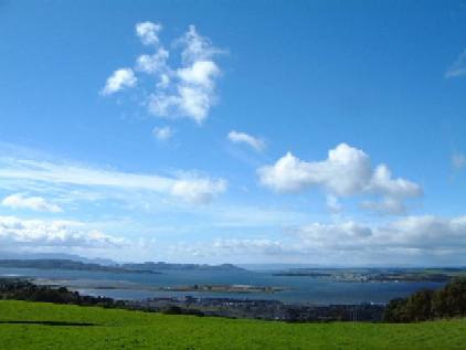
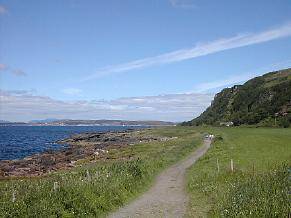
Portencross (NS 175 488) is at Farland Head which projects into the Clyde Estuary just south of the Cumbrae Islands. At the cross roads on A78 on the northern edge of Seamill, take B7048 west for 2km to the road end where there is a large free car park and seaside picnic place with panoramic views of the Clyde. The historic Castle and port lie close by. A track for use on foot or cycle follows the shoreline north for 2km to the BNFL nuclear power station. This coastal walk or cycle can be extended to a very attractive and level 10km round trip past rocky shoreline, mud flat, scrub, marsh, cliff face, mature woodland and pastoral and arable farmland. The route, which is described below, is mainly on off road tracks and way-marked cycleways. Please respect any requirements from the power station operators by whose property the route passes at one stage.

Adequate parking. Very rough track beyond locked gate at end of public road (NS 176 490).

Easy link to the Ardrossan to Largs coastal cycle path. Easy 10km round cycle on tracks and quiet byways.

Birds

The path from Portencross runs along a raised beach though meadow backed by a steep escarpment whose lower reaches are heavily wooded. The shoreline is rocky at this stage. Sea viewing can be rewarding. Black Guillemot and other seabirds favour the projecting power station service pier. Stonechat, Whitethroat and Sedge Warbler inhabit the scrub and the escarpment has breeding Fulmar and Buzzard. The woodland attracts summer visiting warblers such as Blackcap and Chiffchaff. Raven, Great Spotted Woodpecker, Tawny and Barn Owl are in the area. The range of birds seen can be extended by following the circular route.

The Castle
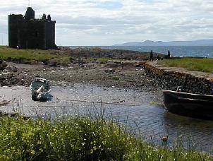
The castle is of historic importance to Scotland and vital efforts are being made to preserve it. The following are extracts from the interesting information board:

Portencross (also known under many variants of that name) was once a harbour of some importance. Arnele Castle (and its successor Portencross Castle) was the focal point of this harbour and hamlet at Farland Head, overlooking the Firth of Clyde. Rich in history, Portencross is reputed to have been the last mainland resting place for bodies of the former Scottish Kings from Kenneth MacAlpine to Malcolm Canmore, before they were ferried to the island of Iona for burial. The present Castle was built in the reign of Robert II, 1371 to 1390.

The castle’s roof blew off during a violent storm in 1739, but its walls remain intact. Four storeys high, the interior features a barrel-vaulted ceiling. It boasted two kitchens on the first two floors, and from the first floor, a circular staircase leads to the top. The L-shaped plan of Portencross castle is the first of these early buildings in that form. Abandoned, it remains remarkably intact despite an absence of urgently required maintenance.

Update 2010: As a result of a successful fund-raising campaign, the castle has been extensively restored.  It is now open to the public during selected periods in the warmer months.

Extended Route

From the style or gate at the northern end of the raised beach path, continue along a well-made road past the power station complex for 2.5km round to where the way-marked coastal cycleway crosses. There are wetlands within the BNFL site, a haunting natural setting for the impressive reactor buildings in the background. A bubbling outflow and mudflats lie to seaward with seascapes past Great Cumbrae and Largs to the mountains beyond. Turn south along the cycle route towards Seamill and follow it as it weaves along tracks and byways through mature woodland and pastoral and arable farmland. Rejoin the B7048 just 1km from its terminal car park. Allow hours for walking and 1 for cycling – plus birding!
Auchincruive

Location and Access

These notes relate to one, mainly, of 4 way-marked trails starting from Oswald’s Bridge (NS 87 231) car park by the River Ayr in the grounds of the Scottish Agricultural College (SAC), Auchincruive, by Ayr. Information on the trails, including maps, can be had from www.ayrshirepaths.org.uk or from a free leaflet available from tourist offices or public libraries. The notes draw freely on the Waggonway Leaflet and full acknowledgement is due to its authors.

Ayrshire Paths is an initiative supported by various organisations including Scottish Enterprise Ayrshire, Scottish Natural Heritage and the three Ayrshire Councils. They have signposted and improved many traditional walks and pathways around Ayrshire and have a continuing programme of development.

From Ayr, head out along A719 to the A77 bypass. At the major roundabout intersection continue eastwards along the B743 for Mauchline. In just over 1km turn right for 1km along an unclassified road past the main entrance to SAC Auchincruive. The car park is on the left through a subsidiary entrance just before the bridge over the River Ayr.

All the waymarked trails have interest for the birder but a particularly good sample of lowland Ayrshire habitat can be had by combining the Three Green Knights with the Waggonway.

Network of metalled, paved and un-metalled paths within Auchencruive. Tracks in woods are narrow and steep.

On local byway route to Scottish Agricultural College along river bank from Ayr centre.

The Trail

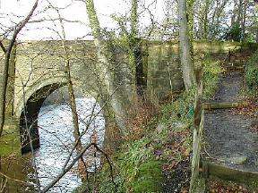
From the car park, cross Oswald’s Bridge, dating to 1826, over the River Ayr. At this point the river is broad and relatively shallow with well established woodland and grassland banks. The bridge is an excellent vantage point from which to scan the diverse and rich habitat. Turn left immediately down to the water’s edge and follow the path upstream through mixed woodland of Beech, Oak, Scots Pine and Japanese Larch. The opposite bank is open parkland. A steep climb away from the river leads to a track across open grassland surrounded by woodland with distant views of the Carrick Hills and Isle of Arran. Then re-enter woodland along the Waggonway Trail following the route of a 19th century railway linking inland coal pits to Ayr harbour, initially using horse drawn trucks and later steam locomotives. The path eventually climbs steeply to a spectacular viewpoint high above the river, reputed to be a favourite of Sir William Wallace of historic fame. The return to start is by a farm track over Loudon Law through a pastoral landscape of open views, very typical of much of Ayrshire.
The Birds

At any time of year the river is habitat for Dipper, Kingfisher, Grey and Pied Wagtail, Goosander, Red-breasted Merganser, Heron and Mallard. In summer, Swallow and House Martin hunt over the water. Sand Martin may come from a down stream colony and Swift hunt overhead. Sparrowhawk, Kestrel and Buzzard are the most likely raptors to be seen. The trail passes through Pheasant Nook. Lapwing and Curlew browse the fields in winter together with various of the gull family but the habitat is less favourable for breeding. Flocks of Fieldfare and Redwing are common in winter and Blackbird, Song Thrush and Mistle Thrush are present all year. The woods are home to Blue, Coal, Great and Long-tailed Tit, Treecreeper, Robin, Wren, Dunnock, Goldcrest and Great Spotted Woodpecker, with Spotted Flycatcher in summer. Chaffinch, Greenfinch and Siskin are readily seen, Bullfinch more occasionally. Typically, Willow Warbler, Chiffchaff, Blackcap and Garden Warbler can be expected in season, and possibly Sedge Warbler and Whitethroat where conditions are right. Yellowhammer should be present but is becoming a rarer sighting. And we must not forget the Starling, Rook, Carrion Crow, Jackdaw and, increasingly common Magpie. Jay is a possible sighting. Though the entrance to the car park closes at dusk, there is an alternative route out through the SAC grounds for those staying on to listen and search for Tawny Owl.

Further Information

The other walks cover a broadly similar range of habitat in differing proportions and are worth exploring.

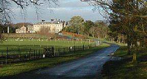
The large building visible up river from the car park and various points along the trail is Oswald Hall, built in 1767 to a design by Robert Adam. Oswald was a wealthy merchant who bought Auchincruive in 1764 and included among his accomplishments the role of chief negotiator during the War of American Independence, earning the nickname Richard the peacemaker. He rose from humble origins to a position of enormous wealth, largely as a result of his involvement in the slave trade – an unpleasant facet of his character – but, no doubt, simply a son of his time.
Knockshinnoch Lagoons

Location and Access

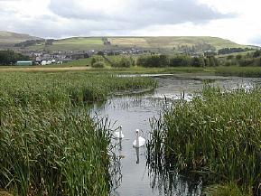
The area comprises three lochs: Black Loch, Creoch Loch and Loch o’ th’ Lowes – along with extensive water meadows on the floodplain of the upper River Nith to the east of New Cumnock and, to the west, mining subsidence lagoons fringed by reedbeds and a small area of heather moorland (Yellow Moss).

The former mining area, the Knockshinnoch Lagoons, is predominantly a Scottish Wildlife Trust reserve and can be easily accessed by walking up Castlehill lane past the cemetry, following the Community Pathway signs to Knockshinnoch from a large free car park on the opposite (east) side of the main street of New Cumnock at NS 617 138, or from a small SWT car park just to the south on the B741 at NS 614 132. New Cumnock is served by buses along the A76 and trains on the Kilmarnock-Carlisle line.

The Lochside House Hotel (NS 602 148) whose drive leads off the busy A76 1.5km north-west of New Cumnock provides civilised viewing across Loch o’ th’ Lowes from its bar lounge, open to non-residents. Other parts of the wetlands can be accessed with care and consideration and an excellent overview of the eastern flood plain is had from the Craigdullyeart Hill byway.

More information is available on the Scottish Wildlife Trust’s web site.

Locked gate and stile from Castlehill Lane, further details to be posted here in due course.

Short ride from rail station to the Lagoons. Quiet along Craigdullyeart byways. A76 requires great care.

Update on May 2004

The railway embankment from the Boig road has been reinstated as a rail line and is therefore no longer an access option. The reserve can be viewed from the Boig road, from a nearby tree covered mound (NS 603131) or by walking into the fields adjacent to the rail line.

Access to the restored bing and pools remains straight forward although parking in the area of the old church (NS617138) is being discouraged.

Mike Howes, 6 May 2004

Update on September 2003

The railway police and officials from the coal washing plant are threatening prosecution for anyone caught walking on the railway dividing the western half of the reserve from the restored bing. Even crossing the tracks is forbidden and cameras are apparently being used for back up evidence. There is no alternative if you wish to access the western pools but to drive around to the Boig road (1 km south west of New Cumnock at Connel Park) and park sensibly in the vicinity of Woodend Farm (NS598135). From here you can follow the old railway embankment to view the area.

Mike Howes, 25 Sep 2003

Birds

Apart from the wide variety of breeding waterfowl and waders, the location holds breeding Water Rail, Whinchat, Grasshopper Warbler, Sedge Warbler and Reed Bunting. Both Garganey and Spotted Crake have occurred in the spring, the former breeding on one occasion. A flight-line for migrants occurs along the Nith Valley and is regularly taken by birds heading to or from the Solway. Most obvious are flocks of Greylag, Pink-footed and Barnacle Geese, along with Whooper Swan, some of which winter on the water meadows at Polquhirter. Autumn is perhaps best for migrant waders such as Black-tailed Godwit, Ruff and Greenshank with the outside chance of something rarer. For example, Wilson's Phalarope has occurred.

Community Path Network

A number of paths through the countryside around New Cumnock have been sign posted. These cover diverse habitat, including the Lagoons, and could be worth exploring, especially during the passage seasons.

Glen Afton

Location and Access

In New Cumnock where the A76 takes a dog-leg take the B741 to Dalmellington and then very soon after take the road on the left down into Glen Afton. Robert Burns worked as a shepherd in this glen in the 1780s and the commemorative Burns Cairn is 2km down the road. He was also a decent birder:

Flow gently, sweet Afton, among thy green braes!
Flow gently, I’ll sing thee a song in thy praise!
My Mary’s asleep by thy murmuring stream –
Flow gently, sweet Afton, disturb not her dream!
Thou stock dove whose echo resounds thro the glen,
Ye wild whistling blackbirds in yon thorny den,
Thou green-crested lapwing, thy screaming forbear –
I charge you, disturb not my slumbering Fair.

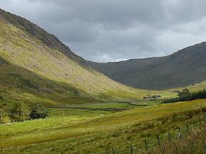
The Glen is still beautiful and good for birds today. It comprises some 8km of upland river valley with scattered broadleaf woodland and conifer plantation. Park at the monument or at the reservoir at the head of the glen (taking care to observe access restrictions) and explore the glen on foot or by bike along the byway. New Cumnock is served by buses along A76 and trains on the Kilmarnock-Carlisle line.

Quite country road but be alert for occasional traffic, several places to park, most of valley can be traversed by wheelchair up to base of dam. Recent rumour of locked gate at cottages.

Easy ride from New Cumnock.

Birds

The glen is good for summer migrants, especially at the lower end where the trees are denser, including Whitethroat, Willow and Sedge Warbler, Redstart and Tree Pipit. Also present are Garden and Wood Warbler, Blackcap, Pied Flycatcher and Crossbill. Dipper, Common Sandpiper and Grey Wagtail frequent the burn and Buzzard breed well in the area.
Pathways

There is a long tradition of public access here and it is easy to get to the reservoir and onto the surrounding uplands. There are plans to upgrade existing footpaths and to create a new circular cycle route around the reservoir. A public right of way runs through the forest and there is informal access to forest tracks.

Blackcraig Hill

Location and Access

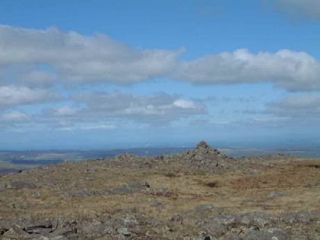
Blackcraig Hill, at 700m, is one of a number of energetic but technically easy hill walks in the vicinity of New Cumnock. One route onto the hill is to park 6km up the Glen Afton byway which leaves B741 just outside New Cumnock and follow the public footpath which leads past Blackcraig Farm house and over the north shoulder of the hill. Parking is limited beside the burn at the start of the path . Please park considerately. The summit of Blackcraig is characterised by broken rock and scree more reminiscent of the higher plateaux found in the Cairngorms.

The nearest public transport, bus and train, is at New Cumnock, a long walk but an easy cycle ride distance along the Glen Afton byway.

<Off-road tracks unsuitable for wheelchair users.

Easy ride from New Cumnock to the start: hill track would be fun!

Birds

Typical moorland birds can be seen and Peregrine is a real possibility but the plateau of Blackcraig Hill has become particularly well known as a good spot for Dotterel in early May. Luck and weather are major factors but this area is one of the attractive rest-ups for these migrants on passage. Golden Plover and Dunlin breed on the summit plateau Meadow Pipit are ubiquitous. Wheatear frequent the posts and rocky outcrops. In early winter flocks of Snow Bunting have been seen on the summit plateau.

Raptors include Buzzard, Kestrel, Merlin, Hen Harrier and Short- eared Owl – a hot day could yield other raptors riding on thermals, easily seen when scanning the skyline from the head of the valley.

Tibbie’s Brig

Location and Access

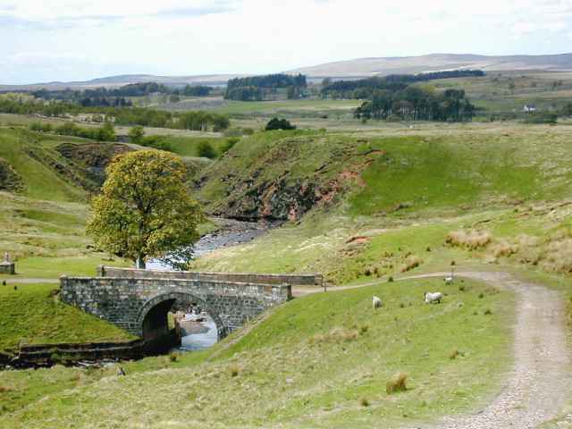
Tibbie’s Brig (NS 689 258) was built in 1793 as a crossing point on the Garpel Water to replace the ford which had been used up until then. Although originally called simply “Garpel Bridge”, it was later renamed to commemorate Isabel “Tibbie” Pagan a local poetess who lived in Muirkirk and was an acquaintance of Robert Burns. Today the pool beside the bridge is a favourite spot for locals to swim in and there is a small monument to Tibbie on the river bank. A network of way-marked footpaths in the area allows adventurous birders to extend their explorations to the surrounding moors, hills and glens. A leaflet is available from information centres or visit www.ayrshirepaths.org.uk. The bridge is reached via a small track from Kames just to the south of Muirkirk. There is a small car park there with an information board which has details of the track on it. Kames is reached by turning off the main A70 road in the middle of Muirkirk just beside the Coachouse Inn; there’s a signpost for Kames Race Track, golf course and caravan park.

Unsurfaced track, muddy in places. Closed wooden gate (unlocked) part way along track – becomes steep close to bridge.

Approach along A70 requires great care.

Birds

The habitat around Tibbie’s Brig is a mixture of heather moorland and rough grazing typical of upland areas in Ayrshire. The moorland extends up on to the slopes of Cairn Table and Wardlaw Hill. There are small grazing areas enclosed by drystane dykes and a few stands of shelter-belt trees. On the Garpel Water, Dipper and Grey Wagtail are easily seen, Common Sandpiper should be looked for on exposed shingle and Kingfisher at the quieter pools. Swallow nest under the bridge in the summer and Sand Martin can be found nearby. The surrounding moorland has lots of Red GrouseCurlew, Oystercatcher and Dunlin also breed. Kestrel and Buzzard can be seen anytime, Merlin and Hen Harrier are strong possibilities and you should keep an eye out for Peregrine over the hillside. Stonechat, Whinchat and Wheatear can all be encountered in the vicinity and the trees are always worth checking for Siskin, Redpoll and Bullfinch. The area attracts Willow Warbler, Chiffchaff, Spotted Flycatcher and Goldfinch in the summer and in the winter can host spectacular flocks of Redwing and Fieldfare.

Additional Information

This area is rich in social as well as natural history, on the way to Tibbie’s Brig it is worth stopping to have a look at Macadam’s Cairn, built in memory of the famous pioneer road builder John Loudoun Macadam. There are numerous Neolithic and Bronze Age sites on the moor and surrounding hills as well as several “Martyr’s Graves” which are testament to the importance of Muirkirk in Covenanting times.

A regular bus service runs from Kilmarnock and Cumnock to Muirkirk. The X76 leaves Kilmarnock bus station on the hour each hour during the day and from Cumnock at 45 minutes past the hour. The return service leaves Muirkirk at 15 minutes past each hour until 5.15pm, there are three later buses the last of which leaves at 9.48pm.

Although most of the sites mentioned around the Muirkirk area can be reached on a mountain bike, walking is by far the best option to explore the locality. If you do plan to cycle on the roads around Muirkirk watch out for open-cast mine traffic!

John Brown’s Walk

Location and Access

Both of these sites lie to the north of Muirkirk and are reached by taking the B743 Strathaven road from the traffic lights in the middle of the town.

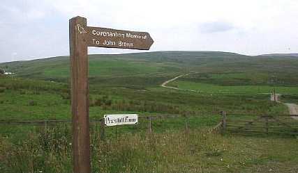
John Brown’s Walk is a moorland track which goes to a monument which marks the spot where John Brown, one of the Covenanting movements most famous martyrs was shot. The track begins directly opposite Linburn Farm about kilometres north of Muirkirk at NS 699 299 and runs down over the Greenock Water and on past Priesthill Farm to the site of the memorial, a distance of .5 kilometres.

There is a tiny car parking area on the right just after the track crosses the Greenock Water bridge, this is really the only place to park as the track is very narrow. The walk is a 7 kilometre round trip so you should probably allow about hours to complete it, the route is well sign posted. More information can be had from a leaflet obtainable at information centres or by visiting the Ayrshire Paths website.

Kirk Plantation (NS 698 278) lies just at the northern outskirts of Muirkirk opposite the cemetery. Kirk Plantation is actually a bit of a misnomer as the conifer plantation which stood on the site was clear-felled in 1980. What is there now is a naturally regenerating broad-leaved woodland, comprising mainly of Birch, Oak and Rowan. The site is managed by East Ayrshire Woodlands and a circular footpath allows easy access to the woodland and the glen beyond it. There is a good sized car park right beside the wood and information about the site is provide on a notice board there.

John Brown’s Walk: Small car park. Rough cobbled unsurfaced road up to about 500m before farm, then becomes very rough, path is boggy. Kirk Plantation: Steps at start, circular path has woodchip surface.

From Muirkirk along the A723 or via hill byway linking B743 Sorn to Muirkirk road, to the A723.

Birds

John Brown’s Walk takes in heather moorland and upland grazing pasture, similar to the type of habitat found around Cairn Table. Birds that can be seen here during the breeding season include Curlew, Lapwing, Oystercatcher, Snipe, Meadow Pipit, Skylark, Stonechat and Buzzard. Short-eared Owl, Merlin and Hen Harrier might be seen on occasion. The track passes a number of small wooded glens which could also be investigated for other species.

The main interest at Kirk Plantation is during the spring and early summer when the woodland is full of arriving migrants. Willow Warbler and Chiffchaff are everywhere, Blackcap, Whitethroat and Garden Warbler can be observed in the under-storey and Spotted Flycatcher is also commonly seen. Treecreeper, Coal / Blue / Great and Long-tailed Tit, Bullfinch, Greenfinch and Song Thrush are among the regular breeding species which are resident all year round. If you continue through the woodland to the unclassified road behind it the habitat becomes more open with mature trees where a variety of different species can be found.

Other Information

The small single track road which runs up past Linburn Farm, leading to the B743 Muirkirk – Sorn road is usually a reliable place to see Short-eared Owl, often perched on a post or wall right at the roadside. There is a conifer plantation at Smallburn (NS 675 275) which has good access via a network of footpaths and could be explored at the same time as a visit to nearby Kirk Plantation. This site is also managed by East Ayrshire Woodlands and is an excellent place to see species associated with coniferous woodland.

Stagecoach run a regular bus service between Cumnock and Muirkirk, buses are 15 minutes past the hour during the day from the bus station in the Tanyard. The service is the X76 which originates from Glasgow and travels to Muirkirk via Kilmarnock, Cumnock and a number of stops in between. 

Kirk Plantation is an easy 10 minute walk from the centre of Muirkirk. To get to the start of John Brown’s Walk would take 40 to 60 minutes walking along the B743 Strathaven road. No bus services run past either of the sites.

An alternative for walkers (or very keen cross country cyclists!) would be to follow the track up through Smallburn Plantation on to the unclassified road which runs between the B743 Strathaven road and the B743 Sorn road. Then head east down to Linburn Farm and on to the start of John Brown’s Walk. You would then need to re-trace your steps or walk back down the Strathaven road into Muirkirk.

Fairlie Sands

Location and Access

The main site is a shallow, tidal bay on the southern outskirts of Fairlie where the burn down Fairlie Glen enters the sea. The bay can be viewed from a roadside car park on the A78 (NS 207 543) or from the car park and picnic area, with toilets, on the promontory at Burnfoot (NS 206 546) on the south edge of the town. Failrie railway station is within 0.5km and buses run along the A78 regularly. The coastal cycleway passes the site.

Park in lay-by (not ideal) or at promontory, no disabled spaces.

Nearby to the south there is an enclosed lagoon which was created when an ore terminal was built in the seventies. This can be viewed by following the footpath on the south side of the bay and up the bank on the northern side of lagoon to an overview of the site. It is possible to enter the terminal and ask permission at the barrier to use a hide on the south side of the lagoon – proof of membership of a bird club may be required. Park in a small car park on the right just inside the barrier and walk the short distance to the hide.

Wheelchair access to hide down gently sloping paved footpath. Hide adapted for wheelchair use. Unsurfaced track around the bay finishes up a steep grassy slope to view lagoon.

Adjacent to the Ardrossan to Largs coastal cycle path.

Birds

The bay is at its best in winter as a site for waders and sea duck. It is the best site in Ayrshire forwintering Greenshank. In the spring and autumn it can be visited by Bar-tailed and Black-tailed Godwit. The pier for the terminal can have good numbers of Eider and Goldeneye with small numbers of Red-breasted Merganser. The burns on the south side of the bay and at the picnic place car park can be good for Dipper and Grey Wagtail.

The lagoon has an island which is used by many of the bay’s birds at high tide. In summer, it has a breeding colony of gulls and, in some years, Sandwich Tern. The island is also used by Grey Heron as a roost – 10 or more can sometimes be seen.

The trees which are planted on the southern embankment between the bay and the lagoon have many fruiting species that attract thrushes in the autumn. Waxwing has been seen here on occasion.

Fairlie Glen

Location and Access

Travelling by car, park at Fairlie railway station having turned off the A78 Ardrossan-Largs coast road in Fairlie at the sign to “Park and Ride”. There is a regular train service Glasgow-Largs and bus service along A78.

Facing the railway line, take the path on the left and then turn right in front of Argyll Cottage. Alternatively keep on the path and take right up the road, but the former is more interesting. Climb up the hill past Fairlie Castle, the only residents being a number of Jackdaws, till you see a sign for “Waterfall”. This is a little detour off the main path – nice but there was not much water falling when I visited! Retrace your steps back to the path and continue up the hill. You will see a sign “To the Moors”. Turn left over a fixed gate and onto the moors at NS 220 547. You can climb and wander the moors as far as you like and enjoy lovely views across to the Cumbraes, Bute, Arran etc. A network of paths is planned for the area.

West Kilbride is fully accessible by train and bus. Tel: 0870 608 2608 for timetable enquiries.

Rough narrow steep tracks up through glen.

Just off the Ardrossan to Largs coastal cycle path.

Birds

The walk up the glen onto the moors takes in woodland and moorland habitat with flowing water attractive to birds. Typical species to be expected would be tits, finches, wagtails, thrushes, Robin, Wren in the glen and Stonechat, Meadow Pipit, Wheatear, Linnet on the moor. Raptors would include Buzzard, Kestrel, Sparrowhawk and the possibility of Merlin and Hen Harrier.

Kelburn Castle and Country Centre

Around walk of about 7-8 km can be had by going left on reaching the moor, following a wall, fence and powerlines north for 2km to the head of Kelburn Glen. This section of the route requires strong footwear and reasonable fitness as it is over grass tussocks and boggy patches and there is the Keppen Burn to cross. The wall, fence and powerlines are good guides and a well-defined path and track will be accessed again on leaving the moor through a gate and heading for a white cottage, Fairlieward. Beyond the cottage, join the Kelburn Castle and Country Centre path network down the Glen past the Castle and Visitor Centre. Return to Fairlie station along a nice easy going straight track accessed from the far end of the Visitor Centre car park, crossing the Keppen Burn again, this time by bridge.

Note that there are charges for Kelburn Castle and Country Centre, for prices phone 01475 568 685. Some of the paths around Kelburn would be accessible by wheelchair but not up the Glen.

For anyone interested in falconry, or just wishing to see raptors at close hand, the Bird of Prey Centre in Kelburn has displays. Ferruginous Buzzard, Common Buzzard, European Eagle Owl, Lanner Falcon, Red-tailed Hawk, Harris Hawk and Saker Falcon can be seen. The birds are flown on most days and Hawk Walks, educational visits and special displays can be arranged.

< Network of paths.

Lochwinnoch RSPB

(Editor’s Note: Lochwinnoch is in Renfrewshire but has been granted honorary inclusion in Ayrshire due to the support they have given over the years to the Ayrshire Bird Report: buy a copy the next time you are in the shop.)

Location and Access

Lochwinnoch RSPB Nature Reserve, founded in the early 1970’s, is situated approximately 0 kilometres south west of Glasgow (NS 59 581). The reserve is part of Clyde Muirshiel Regional Park and is a SSSI. The reserve consists of two shallow lochs, Aird Meadow Loch and Barr Loch (both former flood meadow systems, redundant since approximately the 1950’s) which are fringed by marshland which is in turn fringed by carr woodland and drier deciduous woodland. There are also areas of scrub, and a mature beech wood. The visitor centre is situated 0.8 kilometres from Lochwinnoch village beside the A760 and is signposted from the A737. Lochwinnoch rail station (on the Largs/Ardrossan/Ayr to Glasgow line) is adjacent to the reserve, and several bus routes are within 15 minutes walking distance of the site. There is a visitor centre featuring a sizeable ground level viewing area, viewing tower and a well-stocked RSPB shop. From the visitor centre, two level trails lead to three hides which overlook the Aird Meadow loch. The visitor centre, trails and hides are accessible to wheelchair users. The visitor centre is open daily from 10am to 5pm, with the hides and trails open at all times.

Disabled parking. Wheelchair access to Centre (1:15 ramp) and hides (1:40 ramps), paths surfaced in rolled stone, narrow in places (900mm), one section of boardwalk. Further info from www.rspb.org.uk.

Just off National Route 7, Irvine to Glasgow.

Birds

Over 100 species are recorded annually. Breeding species include over 150 pairs of Sedge Warblers, several pairs of Grasshopper Warbler and over 20 pairs of Reed Bunting. Other breeding species include Water Rail and Great Crested Grebe. Management work on the reserve has contributed to an increase in breeding waders, with Lapwing and Snipe being regular breeders, and Redshank and Curlew being occasional breeders.

Species recorded on passage have included raptors such as Marsh Harrier and Osprey and waders such as Dunlin, Jack Snipe, Black-tailed Godwit, Green, Wood and Curlew Sandpiper, Greenshank and Whimbrel. White Wagtails have been recorded in autumn.

Autumn and Winter brings up to 40 Whooper Swans and 00 Greylag Geese to the site, with Wigeon, Teal, Goldeneye and Goosander present. Smew and Scaup occurs in most winters and Long-tailed Duck are seen occasionally. Glaucous and Iceland Gulls are worth looking out for at the Barr Loch gull roost, and also at the adjacent Castle Semple Loch where a multitude of gulls are regularly to be found feeding on scraps of bread thrown by visitors! Also worth looking out for in winter are Bramblings – historically, Garthland Wood (which runs alongside the A760 near the Glasgow to Irvine cycletrack) was a “top spot” for this species. Hen Harrier and Merlin are occasionally noted over Aird Meadow.

A number of rarities have been reported on the reserve including Purple Heron, Spoonbill, Black Duck, Yellow-browed Warbler and Red-backed Shrike. An Eye-browed Thrush was recorded in 1978 – the second Scottish record. A Reed Warbler in 2000 and a Nuthatch in 2001 were the first records for Renfrewshire and the Clyde Area, respectively.

Further Reading

The Lochwinnoch Nature Reserve Management Plan is available for consultation at the visitor centre. Copies of the twice-yearly Lochwinnoch Nature Reserve newsletter Wilsonia are also available at the centre. Currently in production are a checklist of the birds of the reserve and the latest reserve bird report.