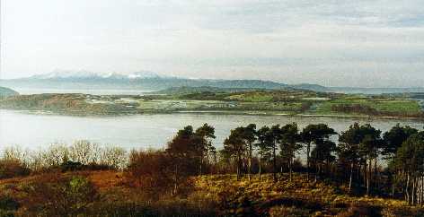
 An easily accessible small island off the Ayrshire coast, approx. 6km long and km across at its widest point. The west side of the island has an especially remote feeling. The walking is easy, mainly on surfaced but sparsely used roads, save for cycles in summer. Bird life is particularly abundant in springtime.
This article is accompanied by an annotated map and photos to show various parts of the island.
Distance
From the ferry pier known as Cumbrae Slip at Holm Bay to Millport via Tomont End, Fintray Bay and Portachur Point – the walk is around 12 km. To walk the full circle – an easy 20 km. However, the stretch of road between Millport and the Cumbrae Slip tends to be busier – so the frequent bus service is another option here.
Access Details
Park your car at Largs seafront car park (charge) and travel as a foot passenger on the CalMac ferry from the nearby harbour. The ferry operates a 0 minute headway in summer – and hourly in winter. (Telephone CalMac at Largs: 01475 – 674134 for details). If you wish to do it the lazy way – you can get a day return for your car and all your passengers. Largs is also well served by public transport with an hourly train service provided by ScotRail (tel: 01294 – 272111) and a half-hourly bus service along the coast from Ayr to Greenock provided by Stagecoach Western Buses(Tel: 01292 – 613500) and Arriva.
![]() Buses fitted with wheelchair lifts.
Buses fitted with wheelchair lifts.
![]() Road mostly follows the coast making for an easy 20km ride. Bikes may be hired in Millport.
Road mostly follows the coast making for an easy 20km ride. Bikes may be hired in Millport.
Facilities
All facilities in Largs. Portaloos at Cumbrae Slip. Toilets and drinks / light meals at the seasonal Fintray Bay Cafe on Great Cumbrae. All facilities at Millport.
Best Times to Visit
Always something to see, but end of April through to May and early June by far the best. Eiderare spectacular in May, with the mating calls echoing around the shoreline. Lapwing nest close to the road at the north end – this area being particularly good for all seabirds and waders.
The Walk Itself
(Numbers refer to map reference points).
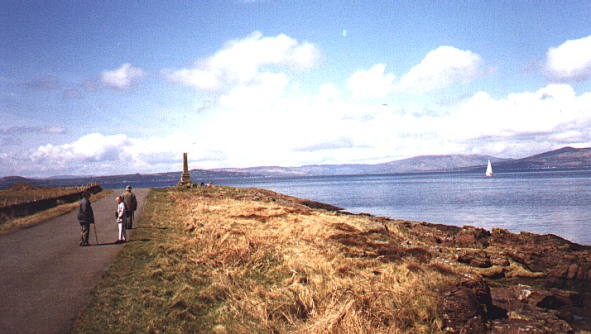
After alighting from the ferry (10 minutes on passage) at Cumbrae Slip (1) – turn right and head off along the surfaced road past Holm Bay towards the north end of the island and Tomont Point and Monument (2).  Assuming a springtime visit you should see Whitethroat, Sedge Warbler, Willow Warbler, and both Meadow andRock Pipit. Plenty of Pied Wagtail flitting about as well as Grey Wagtail. All the usual finches, Blackbirds, Dunnock and other common species.
At Tomont End – move out across the rocks to the shore to find Red-breasted Merganser, Shelduck, Oystercatcher as well as all the gulls you may expect to see and possibly more. Move back to the road and carefully peep over the stone wall to see if you can catch sight of Lapwing – which nest around here. From here to Skate Point (3) in particular, there is usually much to see. Gannet may well be plunging into the water, terns are possible and Eider are extremely vocal. Look for Turnstone and Ringed Plover on the rocks and shore and Common Sandpiper, Redshank, Mallard, Cormorant and Shag. Grey Heron may well be gracing the rocky coastline, too. Overhead – Kestrel are to be seen, but so are Buzzard in ever increasing numbers. Sparrowhawk are not uncommon. Along the roadside scrub, Stonechat are around in good numbers and to landward (especially if you return via the inland hill route) you can also expect Whinchat. Curlew are often seen in good numbers to landward and also along the shoreline where Dunlin are sometimes seen. Swallow and Sand Martin may accompany you as you move on towards Fintray Bay (4). In season, you can take advantage of a coffee, tea or soft drink, along with snacks and light meals at the Fintray Bay Cafe. Toilets are to be found here, too. If you bring your own food – there are picnic tables dotted around the island.
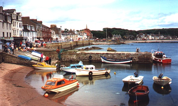
 After leaving Fintray Bay, a path strikes off to the left uphill. This lead to the Gowk Stone (5a) and on through the fields, passing the golf club and down in to Millport itself. This is a shorter route if you are running out of time – cutting about 4 km off the main route to Millport via Portachur Point. If you stay with the coast road, it will shortly bring you to Sheriff’s Port (5). The nearby cliffs have breeding Fulmar and Kittiwake are also normally around. Look out for Raven at this point. From here, the road swings around towards Millport – but a pathway leads off towards the shore and eventually comes back to the main road. This will lead you through yellow flag iris to Portachur Point (6) where you can look for Common Seal – Grey Seal may also be visible. Back on the surfaced road, you will soon be in the town of Millport (7), where you will find many watering holes for that stronger drink – or try the Ritz cafe for a bit of thirties nostalgia. The Cathedral of the Isles (8) is also worth a visit – especially if you have decided to return via the hill route. This lies on your way up to Barbay Hill (9) and at 127 metres, provides superb views of the Isle of Arran, Bute and the Cowal Peninsula – as well as the Ayrshire Coast (on a clear day). This unclassified road will eventually bring you to the B899 where you should turn sharply left. A short stretch leads on to Downcraig Ferry (10) back on the coast road (A860). From here, you can see the Cumbrae Slip (1) once again where you will board the ferry back to Largs.
Boat Trips
Boat trips around the Cumbraes are now available. For details see:
- Web: www.cumbraevoyages.co.uk
- Phone: 0845-257 0404