Author Archives: Kev

East Holmes Marsh and Ladyton Loch

Location and Access

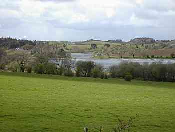
Both of these sites lie about a mile to the west of Galston, one of three towns built along the valley of the River Irvine in the north-east corner of East Ayrshire.
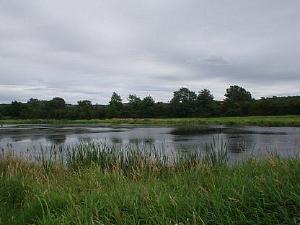
East Holmes Marsh (also known as the Grougar Marshes) lies between the River Irvine and the Cessnock Water at NS 473 72. Access is possible by parking at Hoodston Bridge, (NS 471 69), just off the busy A71 about 1km from Hurlford / 2km from Galston. You can scan most of the marsh and the surrounding area, (which floods whenever it rains heavily), by scope from the small car park or you can get closer to the marsh by carefully crossing the road, turning right and walking up the verge for about 200m to where a narrow track leads down through the fields. This track runs along the eastern edge of the marsh and offers good vantage points and plenty of cover. Reasonable viewing can also be had on the opposite side from the small track which follows the bank of the Cessnock.

Ladyton or Lady Loch is found on the north side of the River Irvine at NS 486 73. It can be reached by following the unclassified road which is opposite the entrance to Loudoun Castle Theme Park on the A719, to the north of Galston. The loch is on the left hand side just past the Ladyton Farm roadend, the road here is very narrow so please park carefully. It is also worth noting that unless you are the owner of a large 4 wheel drive or a tractor you should turn around at the loch and go back the way you came – once the tarmac runs out at the farm the road gets very rough! Alternatively you can park in Galston town centre and follow the public Right of Way from the underpass at NS 499 71, up the old “coffin road” past the churchyard and onto the unclassified road mentioned above.

There are a number of bus services from Kilmarnock which run past Hoodston Bridge into Galston at least every half hour. Contact Kilmarnock bus station on 01563 525192 for details.

East Holmes Marsh: Car park on trunk road with fast traffic. Scan from CP with telescope. Fence prevents access to track. Ladyton Loch: View from car at side of road. Road rough and unsurfaced in places.

Access to marsh along A71 is not recommended. Ladyton Loch is accessible along quiet byway.

Birds

East Holmes is particularly good for waders on passage in the spring and autumn – Snipe, Redshank, Common Sandpiper, Curlew and Oystercatcher are all regular visitors. Other less common birds such as Green and Wood Sandpiper, Little Egret and Ruff have also put in appearances in recent times. Breeding birds at the site include Grey Heron, Water Rail, Grasshopper Warbler, Reed Bunting and Little Grebe. In winter the marsh holds a good range of ducks: Teal, Mallard, Wigeon, Pochard, Gadwall and Tufted Duck can all be seen.

Ladyton Loch is quite small but is worth a visit if you are in the area. Little Grebe, Mute Swan, Moorhen, Teal and Mallard breed on the site and there are always Whooper Swans and other wildfowl in the winter. The surrounding marshy fields, scrub woodland and hedgerows are also good for birds Breeding species include Lapwing, Grey Heron, Oystercatcher, Bullfinch, Reed Bunting, Yellowhammer and Sedge Warbler. The Ravens from nearby Loudoun Hill have also been seen on the track beside the loch!

This stretch of the River Irvine has a Sand Martin colony and breeding Dipper. Kingfisher can also be seen.
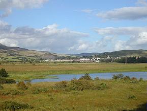
Bogton Loch, Dalmellington

Location and Access

The loch and contiguous wetlands lie close to the west of Dalmellington on the A713 Ayr-Castle Douglas road. There are a number of informal footpaths around the site and it is reasonably easy to access on foot from Dalmellington which is on a regular bus route from Ayr. Excellent viewing is had from the west bank. This is reached by following the B741 from Dalmellington to Straiton and then, within 1km, over a hump-backed bridge, going left along a byway towards Dalcairney Farm. There is one modest layby for parking (NS 465 055) and turning a car and a few places where a vehicle may ease onto the verge of the narrow road. Please park with consideration for other users.

These are narrow country roads with no surfaced lay-bys or safe refuges for wheelchair users to avoid passing traffic. Limited opportunities to view from car. One surfaced lay-by at south end of loch on Dalcairney farm road reasonable view of loch.

Easy cycle ride from Dalmellington.

Birds

This site is a Site of Special Scientific Interest with reedbeds and wetlands around the loch. It is excellent for wetland breeding species and wintering birds. Whooper Swan and Greylag Goose are present in good numbers in winter and Bittern has been recorded. Flocks of finch including Brambling can be found along the beech-lined road. Mallard, Teal, Goldeneye and Dabchick are likely sightings and Shoveler on occasion. Water Rail, Snipe, Whinchat, Grasshopperand Sedge Warbler and Reed Bunting are present and Willow Tit have been observed in the scrub around the road end. Raptors seen include Kestrel, Peregrine, Sparrowhawk and Hen Harrier. Otters can be seen feeding and playing.

Martnaham

Location and Access

A large inland loch (2km in length) found two kilometres south of Coylton. Take the B742 from Coylton and turn off left at NS 402 183 for the south side or continue along the B742 and take first left after the Jelliston turning and the manor house is beside the loch. This latter access point is private, though currently the owner does allow access if he is notified and all common courtesies are followed. There is access to the loch from the south with parking at two spots, firstly, at the road junction at NS 405 177, and secondly at the small lay-by at NS 403 173. From these two parking spots the southern side of the loch can be explored and viewed. A telescope is recommended.

These are narrow country roads with no surfaced laybys or safe refuges for wheelchair users to avoid passing traffic. Limited opportunities to view from car.

On good network of byways linking through to Ayr and Cumnock, but beware of opencast mining traffic near Cumnock.

Birds

Martnaham Loch holds SSSI status for the western half of its spread. The south-western end of the loch is bordered by mixed woodland which can be productive in the summer. Access is limited, so pay attention to sign-posting. It is a significant freshwater site for its size and orientation. Whilst its shape runs predominately south-west to north-east, there are enough inlets and bays to provide shelter from the wind coming from any direction. Maybe it is because of this that Martnaham boasts some notable rarities over the years, including more recently a returning long-staying male Smew, a Ring-necked Duck, Black Tern, Lesser Scaup and Hobby.

Autumn and winter see reasonable flocks of ducks, including Goldeneye, Wigeon, Pochard and Teal. There is also the chance of seeing Shoveler, Scaup, Long-tailed Duck and Gadwall. During stormy weather large flocks of gulls have been known to congregate, with rarer visitors such as Glaucous, Iceland and Mediterranean Gulls. Late winter can see reasonable flocks of Greylag Geese and Whooper Swans gathering in the nearby fields. An early start is recommended to see the geese before they leave the loch to feed in the surrounding area.

With lower water levels in autumn, passage waders can often be found at the eastern end. During migration keep an eye out for the raptors that follow the migrating birds. Great Crested and Little Grebe breed, while the latest birds to start breeding include Canada Geese in 2000.

The loch is also good for passage birds: Oystercatcher, Curlew, Redshank, Common Sandpiper, Whimbrel, Ruff, Green Sandpiper, Black-tailed Godwit, Wheatear and Whinchat. Large numbers of hirundines also use the loch to feed and roost at this time.

The article That Redhead’s No Lady by Dave Grant describes the moulting of a Martnaham Smew. This originally appeared in Ayrshire Bird Report 2001.

Other Information

Whilst in the locality, the smaller Fergus Loch (NS 9 18) and Snipe Loch (NS 8 17) should also be checked for interest. The fields surrounding the former loch have been a favourite haunt of Whooper Swans in past years, with flocks of 0+ birds in late autumn.

Cumnock Byways and Glenmuir

Location and Access

From the township of Logan (NS 59 20), just east of Cumnock off the A70, a 10-12km network of byways can be accessed which link the farms on the hills east of Cumnock with the A70 and A76 trunk routes. These quiet back roads, mainly single track, are ideal for birdwatching by bike but can be explored by car or on foot from Cumnock or Logan, both well served by buses. Please park with due consideration for other road users and farmers needing access to fields.

Surfaced minor roads. Be alert for passing vehicles. Scan from car.

Many quiet roads to explore.

Birds

The byways pass through diverse habitat. The high ground is largely developed and undeveloped pastureland but there is also a large area of moss between the crossing of Glenmuir Water and the A70. Many sections of road are bordered by mature stands of beech and other broadleaved trees and there are several patches of mixed woodland. The roads pass by or close to a number of working farms. Glenmuir is a narrow gorge, well foliated, with scrub, woodland and open ground. The whole area is on a migration flight path. The area is good for Fieldfare and Redwing in winter, and flocks of finches, though anything is possible on passage. Depending on the season, warblers, tits, Spotted Flycatcher, Common Whitethroat and other woodland and hedgerow birds are likely and the farms attract Swallow especially. Kestrel is a common raptor.

Airds Moss

Location and Access

This large tract of upland moor (NS 61 25) is an important ornithological site lying to the south of the upper reaches of the River Ayr. It is bounded by the A70 Cumnock-Muirkirk trunk road on the south and and the B743 on the north.

It is possible to get into the Moss on foot from Auchinleck, Cumnock, Cronberry and Muirkirk, all of which are on regular bus routes and there are plans for a footpath in the north-eastern section beside the River Ayr. Some of the byways can be explored, with care, by cycle and there are one or two spots which can be easily investigated on foot.
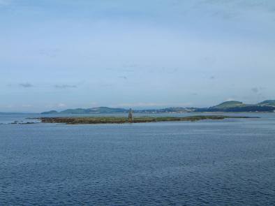
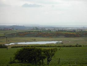
Essentially, however, viewing is from one of the major or minor roads around the site. A large layby to the north east of Cronberry on the A70 provides a strategic overview and the byway into the Moss just south east of Cronberry has good vantage points. A short distance along this road (on the left as you head towards Auchinleck), is Common Loch (NS 59 22). This small loch holds a good variety of breeding and wintering birds and is worth checking out at any time of the year. Attention should also be paid to the surrounding area of scrub woodland – a Great Grey Shrike turned up at nearby Commondyke Farm (NS 578 225) a couple of winters ago. Please be alert to the opencast coal mining traffic in the vicinity. A number of wayside stops can be found on the B743 Sorn-Muirkirk road with good birding on both sides, e.g. the bridge over the Greenock Water at NS 631 272.

Park and scan from vehicle.

The A70 requires great care. Some byways also carry mining traffic.

Birds

There are many interesting moorland species breeding here including Hen Harrier, Merlin, Red Grouse, Golden Plover, Dunlin and Curlew. Peregrine have been seen and good numbers of Short-eared Owl when the vole numbers are strong. Black Grouse have been observed close to the Sorn-Muirkirk road. Skylark, Tree Pipit, Lesser Redpoll, Stonechat, Whinchat, Wheatear, Common Crossbill, Mistle Thrush, and Reed Bunting are among the other species which are likely to be encountered during a summer visit to the area. In winter, there are always large flocks of thrushes and plenty of ducks and swans to be seen on the small lochs.

Conservation Issues

The area has opencast coal mining potential which gives rise to conflicts of interest between commercial and ecological considerations. Hopefully, compromise and agreement will preserve the moss as a major ornithological site in East Ayrshire.

Munnoch Reservoir, by Ardrossan

Location and Access

The reservoir lies high in the rolling, grassy hills of North Ayrshire some 6km north of Ardrossan along the B780. Limited parking can be had at the north end (NS 255 480), near the cottage at the junction of the B780 and B781 or at the south west corner at the junction of the B780 and a minor byway. At both locations the loch is close to the road and readily scanned from the parking location. Please take care not to obstruct passing traffic or residents requiring access. The approach roads are often rather busy for cycling safety.

Very limited parking at side of busy road, stone wall along roadside restricts viewing.

Both ‘B’ roads require care but a safe approach is possible along by-ways from the south.

Birds

The loch is set in a shallow hollow below the Knockewart Hills. It is of medium size and fringed with reeds. Notable in the area are Tufted Duck, Water Rail, Jack Snipe, Sedge Warbler and Reed Bunting. Wintering waterfowl and migrants find the reservoir to be a useful resting place. In 1999 a Lesser Scaup stayed for a few days.

Kirktonhall Glen

Location and Access

From the A78 coast road Ardrossan-Largs,turn inland in Seamill, eastwards, at signpost to West Kilbride town centre. Follow the road up the hill and into the town and take right down Glen Road, parking on the left just before the Post Office and Spar shop. The sign saying “Kirktonhall Glen” is easily visible straight ahead.

There is a nice 0-40 minute walk through the woods beside the river with various little paths off the main one. After 10-15 minutes you come out onto a quiet road at the Seamill Youth Community Centre which takes you back down into Seamill. Retrace your steps until the sign for the Beechgrove Community Project and turn right over the bridge and return to your car along this different path.

It would be possible to take a wheelchair into the woods but maybe not right to the end as there are some steps built into the paths in various places.

West Kilbride is fully accessible by train and bus. Tel: 0870 608 2608 for timetable enquiries.

Metalled footpath then unsurfaced path gradually becoming more difficult, rough surface, some steep sections and adverse cambers.

Birds

There is a pleasant mix of easily accessed woodland and waterside habitat. Quite a few bird boxes have been erected to attract breeding species. Common park and garden birds are readily seen: Robin, Wren, Blackbird, Chaffinch, Blue Tit, Great Tit, crows. Wintering birds such as Redwing can be expected and spring/summer migrants such as warblers.

Horse Island

Location and Access

Horse Island is a small island located only one kilometre offshore from Ardrossan (NS 213 427). Despite its diminutive size (20 hectares including 13 hectares of inter-tidal zone), it has been recognised since at least the 1950’s as an important island for breeding birds. In addition to various inter-tidal habitats, there are several brackish pools and areas of dune grassland which add to the interest of the site. The RSPB have managed the island as a Nature Reserve since 1961, it having achieved the designation of Statutory Bird Sanctuary in 1963. Management is mainly through monitoring, non-intervention and minimising disturbance. RSPB staff and volunteers make an annual visit to the island in late May to survey the breeding birds, with occasional visits later in the season. Since 2001, the Clyde Ringing Group have carried out ringing activities on site.

There are no visiting facilities and there is no access during the breeding season (March – September). Out with that period, written permission to visit the island must be sought from the RSPB at Lochwinnoch Nature Reserve (telephone 01505- 842663, e-mail Lochwinnoch@rspb.org.uk). Calm sea conditions are an essential prerequisite to visiting the island, as landing is somewhat precarious! Relatively good views of some of the birds around the island can be obtained from the Ardrossan – Brodick Ferry.

Birds

Over 60 species have been recorded on the island with over a third of these having bred. Historically, Horse Island was an important ternery, with five species of tern having bred there. Peaks were 267 pairs of Common Tern and a similar number of Arctic Tern (1961), 15 pairs of Roseate Tern (1970), 574 pairs of Sandwich Tern (1975) and two pairs of Little Tern (1977). Few terns have bred since 1984, and there has been no breeding since the final pair of Common Terns recorded in 1996. In harsh weather, there was also an important roost site for Greylag Geese, with a peak of 2,000 in 1979.

Currently, the island is famed for breeding gulls and Eider. Of the three principal gull species breeding there – Lesser Black-backed, Herring and Great Black-backed – the former has established a nationally important colony. In total, usually over 2,000 pairs of gulls breed. Eider numbers are also very healthy at the site, with 542 pairs breeding in 2002, making it a regionally important site. A Cormorant colony was established in 1996, and this included 73 nests in 2002. A lone pair of Shag nested in 2001 (constituting the first breeding record for the island), however it was suspected that the nest failed as no young were seen on a later date.

Other regular breeders have included Mute Swan, Greylag Goose, Mallard, Moorhen, Oystercatcher and Rock Pipit. Occasional breeders have included Barnacle Goose, Carrion Crow and Raven – the latter breeding on a ledge on the Beacon Tower for the first time in 2002.

Out with the breeding season, 13 species of wader have been recorded on passage including Whimbrel, Black-tailed Godwit and Greenshank. Passerines recorded have included Redstart, Wheatear, Linnet and Snow Bunting. One might speculate that Twite and Snow Bunting are more frequently found on the island in autumn and winter than records would dictate, but go un-recorded. Given the regular sightings of Black Redstart further north at Seamill, there is similar suitable habitat to be found on Horse Island.

Further Reading

The excellent Whispers of Horse Island by John & Noreen Steele (Argyll Publishing, 1999, ISBN 1 902831 055) provides a comprehensive history of the site, complete with illustrations and photographs, both historical and contemporary, and is available from Lochwinnoch Nature Reserve Shop. Copies of the Horse Island Management Plan are available to consult at Ardrossan and Saltcoats Libraries, or alternatively, at Lochwinnoch Nature Reserve. The Horse Island Breeding Bird Report is published annually, the latest copy available from Lochwinnoch RSPB Nature Reserve.

Ashgrove Loch

Location and Access

This medium sized loch lies in a hollow (NS 275 443) in pastoral land km north of Stevenston. The network of byways which surround the loch require some map reading skills and none approach closely. Excellent viewing over the area by telescope can be had, however, from the car park at Lochwood Farm Steading (NS 273 448), on the byway which passes to the north, but please respect the wishes of the owners.
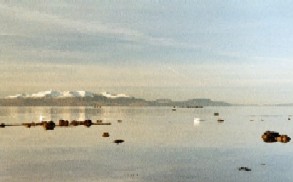
The byways are suitable for cyclists but the nearest public transport is a fair walk away at Kilwinning or Stevenston. One approach by car is: From A78 north from Irvine, turn right at the Hawkhill roundabout at the end of the dual carriageway along A738 signed Kilwinning. In 0.4km, first left, then in 1km right at crossroads in the outskirts of Stevenston. Follow this byway round for 2.5km to the Steading at the top of a rise overlooking the loch.

Park at farm steading, use telescope.

Good network of quiet by-ways.

Birds

The loch is in a Site of Special Scientific Interest. The reed beds around the loch are good for Water Rail, Sedge Warbler and Reed Bunting. The loch has a range of waterfowl, especially in winter. Interesting sightings have included Marsh Harrier, Quail and Garganey.

Other Information

The Steading is a highly-rated farm guest house and is part of a working farm. There is also self-catering accommodation. Although the car park is really for visitors, the farmer is keen to encourage an interest in wildlife and farming practices. He may, on request, permit an approach to parts of the lochside on his land.

Ardrossan Harbour and North Bay

Location and Access

This town on the Ayrshire coast is the terminal for the Arran ferry and so has good road and rail links. The harbour is a good starting point with the best viewing from the Marina (NS 225 423): follow the signs for the ferry and bear right into the Marina. You can drive through the gates and go round the inner harbour and park just beyond the Harbour-master’s tower. Beyond the breakwater is Horse Island (NS 213 427). This is an RSPB reserve and although access is not possible, you can get reasonable views through a ‘scope (although avoid the afternoon sun – not a common problem on the west coast!).

The next location is North Beach (NS 229 432) as shown in the photo on the right. On leaving the Marina take the left turn at the traffic lights and follow this round for about a mile until the beach can be seen on your left. Park near the toilet block at the junction with the A78. This was where the Snowy Egret was found in December 2001 (see the Photo Gallery for some excellent shots of this bird).

The Calmac ferry to Brodick on the Isle of Arran is a mini-pelagic.

Car park at the Marina but uneven surface.

On National Route 73 to the Arran ferry and coastal path to Largs. Linked to National Route 7 at Kilwinning.

Birds

The harbour area can give close views of Black Guillemot with several pairs nesting. The rocks at North Beach are good for Redshank, Oystercatcher, Turnstone, Ringed Plover, Wigeon. This part of the coast is a magnet for Eider, especially during eclipse with large rafts forming. The field behind the roadside restaurant (at NS 220 444) often has a flock of Curlew numbering several hundred and up to 0 Twite. The track just before the restaurant goes up to Montfode Farm. After you go under the railway bridge there are some horse stables and ruined buildings up the hill. There are regular sightings of Buzzard (4+) plus occasional Barn Owl and Tawny Owl. The rough field towards the houses contains breeding Whitethroat, Grasshopper Warbler, Sedge Warbler. And of course, there was that Snowy Egret!

Other Information

There is a cycle-path/walk way going from Ardrossan north along the coast towards Seamill and beyond. This gives great views of the coast with Arran beyond. For details of ferry times, Calmac’s phone number in Ardrossan is 01294-603226.