Brodick Country Park, Arran

Location and Access

Brodick Country Park is located km north of the Caledonian MacBrayne ferry terminal in Brodick, along the main coastal road. The Park is open from dawn till dusk, with the exception of the Walled Garden which is open from 9am to 5pm. The reception centre and caf open at 10am, whilst the castle and reception centre open at 11am.

The Stagecoach bus service meets the ferry at Brodick, ask for the Castle Pedestrian Entrance at the Wineport. You can also walk to the Park via the “Fisherman’s Walk” along the beach. This involves walking along the main street of Brodick until Alldays shop, then walking along the beach until you reach a bridge. Taking this leads you through the Saltmarsh (site of the Snowy Egret in 2002!) and across the Golf Course, crossing a large river and then back to the beach. At the end of the strand, you’ll head back inland to a final bridge which eventually goes back to the road and signs to the entrance. By car, follow signs north to the Castle and take the main drive after km, up to the reception centre. Merkland Wood is a further half-mile from the Castle entrance and has limited unofficial parking places.

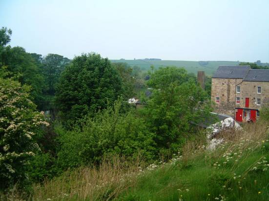
The Country Park covers around 200 acres of woodlands, pasture, meadows, access to seashore, ponds, woodland gardens and formal gardens. It encompasses the largest piece of mature broadleaved woodland on the island. The Park is also surrounded by Forest Enterprise land, through which the park trails run. This is mainly conifer plantation, but also contains some mature Oak and Beech woodland with Scots Pine and regenerating Birch.

Parking at castle and ranger centre. One woodland trail designed for wheelchairs. Refer to NTS web site for details.

Birds

Being an island, Arran is a curiosity as much for the birds that are not here, as much as for those that are. Woodpeckers are entirely absent from Arran, even though suitable habitat exists and they are present only miles away on Kintyre. The Park is a great place to see Barn Owl, with a pair nesting in a nest box in the gardens. Arran is one of Britain’s strongholds for these birds, as it is for the Hen Harrier which can be seen hunting in the pastures during the winter as well as more frequently up on the moorland. The Nightjar is an elusive possibility on midge ridden July nights. Although breeding status is unknown at present, they bred in good numbers during the 1990s in the newly cleared forestry areas. A good selection of seabirds and waders can be seen along the coast from the beach up to Corrie. Shelduck breed in this area, Redshank and Curlew are frequent, as are Common Sandpiper. Gannets from Ailsa Craig perform off the shore from as early as February, and Eiders and Red- breasted Mergansers are a beautiful autumn and winter sight. All the cliff-nesting seabirds frequent the Clyde with Guillemots, Manx Shearwater and Tysties (Black Guillemot) being great sites from just offshore. In spring, there is a good chance of seeing all species of Diver, though only Red- throated breed on the island and these can be heard flying over the castle returning to upland lochs. In these days of ever declining Song Thrush populations, they thrive in the mixed habitats of the park. Winter is a great time for Fieldfares and Redwings that feast on Arran’s abundant berry harvest. Bullfinches are frequent visitors to the gardens, pinching out fruit tree buds and seem to like Escallonia bushes which are a favourite wind tolerant shrub. Siskins abound in the park and are a feature of the less promising coniferous areas. Strangely enough, the north of the Island has quite a different bird life to the south, with species like Yellowhammer and Whitethroat being almost absent from the former whilst being regularly heard in the more gentle south. The woodland is great habitat for Wood Warbler, Blackcap and Spotted Flycatcher. Occasional sightings of Pied Flycatcher have occurred and nest boxes have been erected in the open woodland to encourage a pair to stay one day. Buzzards are seen all the time as are Kestrels and Sparrowhawks. Arran is superb for raptors in general, except for the Tawny Owls which inhabit the Country Park, as all of our island inhabitants are male!

Other wildlife attractions in the Country Park are the Common Seals that bask on the shore, sightings of Basking Sharks all around the coast and the Red Squirrel, which is not threatened by its American cousin and which, can be easily seen. There are no Foxes, Roe Deer, Stoats or Weasels on Arran, though we have a very healthy population of Otters and Badgers.

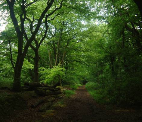
There are three main trails in the Country Park, which take around 1-2 hours to walk each. There are beautiful waterfalls and views along these routes as well as features of historical and geological interest. You are free to walk almost anywhere in the Park, exploring the fields and woods. Extensive habitat restoration projects have been undertaken to limit the spread of Rhododendron ponticum and we are hoping to restore parkland and agricultural habitats in the future.

Additional Information

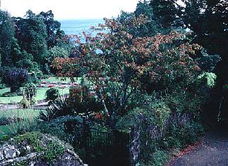
The park is a great day out for all the family, with a child friendly castle which has lots of children’s activities, a world class garden, an adventure playground, nature room, restaurant and shop. The Ranger Service leads guided walks from Easter to September and hosts other family events. There are maps for garden orientation and trails leaflets. A brand new audio wand system provides a superb way to find out more about the woodland garden.

For more general information on Arran (e.g. ferry details) please see the Arran page.

We would be delighted to help with any additional information, please contact:

National Trust for Scotland Ranger Service
Brodick Country Park
Isle of Arran
KA27 8HY
01770 02462
Email: smason@nts.org.uk or ksampson@nts.org.uk

Isle of Arran

Location and Access

The Isle of Arran (19km by 42km) lies in the Firth of Clyde 28km west of the Ayrshire coast, 5km east of Kintyre peninsula. Its northern half is rugged, mountainous, remote country, good habitat for Golden Eagle and Red Deer. Goatfell (874m) peaks over the principal town of Brodick on the east coast. The south has gentler moorland, extensive conifer plantations with Red Squirrel and much of the island’s farmland. The climate is milder, the species range wider. Much of the coast is raised beach with a shoreline of rock or shingle, haunt of Otter, and steep escarpments. The wide diversity of habitat across the island results in a rich bird records list of over 200 species. The absence of Fox as a predator may contribute to Arran’s healthy population of raptors, notably Buzzard, Kestrel, Sparrowhawk, Hen Harrier and Short-eared Owl. may be in cleared forest. Red-throated Diver breed on remote hill lochans. Significant absentees include Great Spotted Woodpecker, despite suitable habitat and being on nearby Kintyre. Most of Arran is a Site of Special Scientific Interest.

Mountains of the North

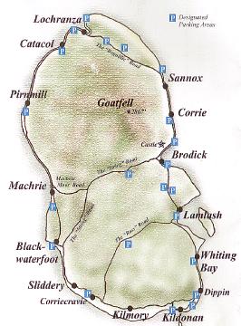
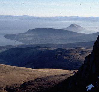
A good sample of northern habitat can be had on a 56km loop from Brodick: take B880 hill road, The String, to the west; fork right onto unclassified moor road to Machrie Bay; then by A841 main road north along the shore to Lochranza, east over The Boguillie pass and back along the shore to Brodick. Mountain, moor, shore and sea can be scanned all along the route. Walking tracks lead into the interior from several locations. Best part of Arran for birds of remote hill country, especially in spring/autumn: Golden Eagle, Raven, Red Grouse, Curlew, Wheatear, Meadow Pipit. Good for raptors in general: Buzzard, Peregrine, Merlin, Sparrowhawk; with Hen Harrier and Short-eared Owl in suitable terrain.

Hills and Moors of the South

A good sample of southern hill country can be had on a 50km loop from Brodick: take B880 hill road, The String, west to Blackwaterfoot on the coast; then south 10km along A841 to an unclassified road, The Ross, up Water of Sliddery valley, over the moors to Lamlash and back along A841 to Brodick. Walking tracks lead into the interior from several locations. Many of the usual moorland species can be seen. All year specialities include Hen Harrier, Short-eard Owl, Golden Eagle. Seasonally, the following are likely: Merlin, Whinchat, Tree Pipit, Grasshopper Warbler, Cuckoo, Twite.

South Coast, Kildonan & Auchenhew Bay

Beach/raised beach near Kildonan village (NS 017 207) signposted off A841 coast road some 20km south of Brodick. To reach Kildonan beach: from car park (NS 034 207) to right of old coastguard tower, pass play area to reach beach near hotel; or start at car park near old school house 1km to the west. Auchenhew Bay is reached from car park opposite village hall go left past shop/post office to path to west onto raised beach leading to Bennan Head (3km).

More Information

The Arran Natural History Society, c/o the Ranger Service, Brodick Castle Country Park, has produced several useful guides to the wildlife of Arran: The Arran Bird Report, Arran Flora and Where Can I See …? – a guide to finding Arran’s wildlife and plants – all available from the Tourist Information Office (The Pier, Brodick, KA27 8AU, 01770 03 776), or local shops.

Sea Crossing

There are two roll on-roll off ferries serving Arran, operated by Caledonian MacBrayne. The main one operates between Brodick on Arran (NS 022 60) (Phone: 01770 02 166) and Ardrossan in Ayrshire (NS 223 423) (Phone: 01294 463 470) taking 55 minutes to cross, sailing several times daily, with more in the summer. A smaller, 0 minute service operates between Lochranza on Arran (NR 925 510) and Claonaig on Kintyre (NR 875 560), April – Oct only. There is a secure car park at Ardrossan terminal.

Brodick ferry has lift from car deck for wheelchair users. Can stay in car on Lochranza ferry.

Arran’s roads are good for bikes (although they can be busy in season). National Route 73 links National Route 7 to Ardrossan, Arran and Kintyre.

Birds

For details of the birds and other wildlife on Arran please go to the individual pages.

Irvine Circular Path

Location and Access

As the name indicates this is not a single location: rather it is an environmentally friendly way of taking in several good locations around Irvine, providing good birding opportunities and sites on route (many of which have their own location reports – follow the links).

The basic route is approximately 15.5 kilometres (9.6 miles), with an extension bringing this up to 24km. No sections of the route are difficult for either walking or cycling but in wet weather there are some short sections which can become muddy. Most of the route is on dedicated paths.

The route is convenient for Irvine railway station as the route branch which goes to Irvine harbour passes very close. There is considerable car parking space around the railway station and Eglinton Country Park has free car parking. Most buses pass through the centre of town.

The route, broadly speaking, encircles the built-up area of Irvine. As a result it can be accessed from a variety of points around the town. There are no facilities as such on the route but as the route passes close to the centre of Irvine and through Eglinton Country Park toilets, shops, pubs, cafes, restaurants, buses, and trains are never that far away – within half an hour’s cycling.

The southern and western sections of the route are now part of the SUSTRANS network and around the route there are numerous other paths that can be explored – especially in Eglinton Country Park.

Exploring the Route

For the sake of convenience it is simplest to divide the route into four sections and proceed in a clockwise direction.

Section One

This starts in the park (called the “Low Green”) beside the River Irvine near the Bridgegate Shopping Centre (NS 18 94) and ends where the route crosses the A78 (NS 07 419). From the park, follow the cycle path under the A737 (“Marress Road”) and up to the Burns statue. The path then skirts Irvine Moor and then passes Bogside Golf Course emerging at the SWT Garnock Floods reserve. Immediately after crossing the River Garnock the path goes right and goes under the A78. It is possible to get reasonable views of Kingfisher from the bridge (NS 07 419) which crosses the River Garnock at this point. Grey Wagtails are also present here and the mature trees along the river bank are attractive to Chiffchaffs and Blackcaps. This section is about .5 kilometres in length and provides, perhaps, the widest variety of habitats. These range from tidal estuary, to grassland and scrub, to wetland. Consequently, this section offers a wide range of bird species. These include wintering wildfowl and waders on the river estuary and wetlands areas, summering warblers (Willow Warbler, Whitethroat, Sedge Warbler, Grasshopper Warbler) in the shrubby areas, resident finches, tits and thrushes. Kestrels and Buzzards are relatively common, especially near the railway line, and in winter substantial flocks of Fieldfares and Redwings are present.

Section Two

After going under the A78 the path follows the river and then joins another path. Turn right here, go over the bridge and follow the path through the houses until you reach the A737 Kilwinning to Irvine road. Go straight over (paying great care as this is a very busy road) and enter Eglinton County Park.

The main route through Eglinton CP adds just less than 4 km more to the journey and passes through a mixture of managed habitats. A number of birds probably not encountered so far can be seen in the park: Great Spotted Woodpecker, Sparrowhawk, Treecreeper and Goldcrest among them. There are a number of different routes through the park of varying lengths and habitats.

Section Three

This section begins where the route leaves Eglinton CP and enters the SWT reserve at Sourlie Wood (NS 42 418). For the next 4.5 kilometres it winds its way through Girdle Toll, Bourtreehill and Broomlands Park where it crosses the Annick Water and is itself crossed by the A78. The cycle path follows the path of an old railway, around Sourlie pond, and then passed Lawthorn Pond (NS 45 408) and down to the Irvine to Kilmarnock cycle path at NS 56 85. The adjoining flooded field is Capringstone Flash. The route now goes right along the cycle path to emerge at Newmoor Roundabout (NS 9 82).

In this section it will be mainly those species habituated to suburban style living that will be encountered. However, Kingfishers are present on the Annick Water and the Ayrshire Bird Report 2001 has records of Green Woodpecker at Perceton (NS 54 405) and Nuthatch at Stanecastle (NS 7 99) neither of which is far from this part of the route.

Section Four

From the A78 (NS 9 85) back to the Bridgegate Shopping Centre (NS 18 94) is about .5 kilometres in length and follows the bank of the Annick Water down to where it meets, and follows, the River Irvine back to the starting point. Otter are regular in this stretch.

From Newmoor Roundabout the path follows the River Annick around the Thistle Hotel to emerge at NS 1 84 on the B7081. Cross over this road and continue on the cycle path beside the river. This passes a couple of ponds (Milgarholm Ponds) that are worth checking out. The path goes under the A71 at the Bailey Bridge (NS 24 82) and then continues downstream along the River Irvine until the starting point is reached.

It is possible to turn upstream at the Bailey Bridge to the A737. The SWT Shewalton reserve is 1.5km along the road on the left-hand side at NS 26 70.

Through this section a good variety of passerine species, including Sedge Warblers and Willow Warblers and possibly Reed Bunting, can be expected during the summer months and in winter, in the planted areas, flocks of tits, finches, and thrushes are likely to be seen, especially among the alders.

Extension

It is possible to extend the route by another 8km by taking a more southerly path through Dreghorn. At NS 50 85 go up Station Brae into Dreghorn. At the traffic lights so straight over and follow the road down to the river at NS 57 78. On the right is a cycle path that follows the River Irvine down to the chemical factory at NS 46 68. In Spring the path along the river is good for Blackcap, Garden Warbler, Sedge Warbler, Grasshopper Warbler, Chiffchaff, Willow Warbler and Whitethroat. The moor to the north of the river is good for Kestrel. The area near the bridge has a Sand Martin colony and Common Sandpiper can be seen on the gravel. Goosander and Heron have been seen on the river.

Go past the chemical factory (pausing to savour its attractive aroma) and at the roundabout turn left onto the B7080. This passes Oldhall Ponds (an SWT reserve worth exploring either side of the road) and then at the Meadowhead roundabout go straight over heading for the paper factory. The cycle track then turns right (signposted for Irvine station) and skirts around Shewalton pond. This is a roosting site for gulls feeding on the nearby landfill, and a variety of ducks, including occasional Long-tailed Duck. There is a quiet woodland SWT reserve at NS 7 57 opposite the paper factory which is good for Siskin, Goldcrest, Coal Tit, and Redpoll.

The cycle path crosses the A78 by a pedestrian bridge and then continues between Western Gailes and Glasgow Gailes Golf Courses. It then goes through a moor with gorse that is good for Stonechat. The path proceeds through Irvine Beachpark until it comes out at the Harbourside with views across Bogside Flats. This is one of the best birding locations in Ayrshire. The path continues along the side of the River Irvine and then past Fullarton Church until it emerges at the Low Green, the starting point.

General Notes

Around 80 species of birds could reasonably be seen over the course of the year. In addition, early morning journeys can quite easily result in close encounters with Roe Deer and Foxes.

Eglinton Country Park

Location and Access

Eglinton Country Park is situated just off the A78 Ayr to Greenock road, on the outskirts of the town of Irvine.

Eglinton Country Park is 1000 acres, created around the ruins and the estate of Eglinton Castle, it includes formal gardens, woodland, river, loch and Visitor Centre. A ranger service provides an interpretative service and guided walks, there are also self-guided trails and facilities for cycling, horse riding and angling.

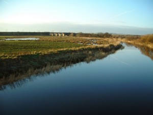
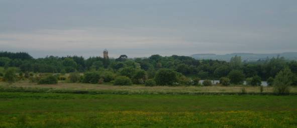
The Visitor Centre includes a history exhibition and a gift shop, Tearoom, picnic areas and children’s play area. Wheelchair access and facilities for disabled visitors. A Guided Walks and Events Programme is available from Easter. The mixture of river, loch, agricultural land and woodland attracts a variety of birds.

Disabled parking. Extensive network of metalled and un-metalled paths. Rough steep tracks through some woods.

On network of local cycle ways connecting with National Route 7. This forms part of the Irvine Circular Trail.

Birds

Resident breeding species include:
finches, tits, thrush, Pheasant, Grey Partridge, Tawny Owl, Kestrel, Sparrowhawk, Great Spotted Woodpecker, Skylark, Yellowhammer.
Resident (but non-breeding):
Buzzard.
Winter visitors:
Fieldfares, Redwings, occasional Waxwings and sightings of Hen Harrier and Kingfisher.
Wildfowl include:
Goldeneye, Wigeon, Tufted and Mallard ducks with Whooper Swans and geese on passage. Also Woodcock, Snipe, Curlew and Lapwing.
Summer migrants:
Swifts, Swallows and Martins; Willow, Sedge and Grasshopper Warblers, Blackcap and Chiffchaff.

Usual sightings of various songbirds, water fowl and birds of prey, can be interspersed with the exotic (White Stork, Black Swan) and the unbelievable (a Flamingo!).

Additional Information

Further information may be had from:

The Ranger Service
The Visitor Centre
Eglinton Country Park
Irvine KA12 8TA
Phone:
01294 551776
Fax:
01294 556467

Garnock Floods SWT

Location and Access

This is a SWT reserve on the edge of Kilwinning, to the north of Irvine (NS 05 418). Access is from the A78 north-bound just beyond the Eglinton interchange down the B779 signposted Bogside (note that there is no access back onto the A78: you need to follow the road into Irvine). The Irvine-Glasgow cycle path goes along the edge of the reserve. The reserve consist of a band of trees, fields and ponds bounded by the River Garnock, Ayr-Glasgow railway and the A78. There are no hides. The best viewing is from the cycle path or the fishermans’ path beside the River Garnock that goes towards the railway viaduct.

Park at side of road. Viewing for wheelchair users is limited to a very few gaps in the hedge.

National Route 7 goes along the boundary of the site, linking Irvine and Kilwinning. This forms part of the Irvine Circular Trail.

Birds

Although the reserve has open water throughout the year, as its name suggests, it gets flooded by the River Garnock in winter making it particularly attractive for wildfowl including Shoveler, Wigeon, Teal, Goldeneye, Tufted Duck, Little Grebe, Mute Swan. In spring there can be Garganey. Kingfisher and Grey Wagtail have been seen on the river. The pond edges are good for waders including Snipe, Redshank, Curlew, Heron. These ponds have recently been enhanced by excavation work by the SWT. Livestock are used to improve the habitat for nesting waders and grazing wildfowl.

In autumn the area attracts passage migrants such as Ruff and recently a Black Tern. Squadrons of Starlings arrive to feed along with an assortment of common finches.

The fields are a gull roost but this has become smaller since the closure of the refuse tip across the road. The belt of trees is good for Redwing and Fieldfare in winter, and migrants in spring (Sedge, Grasshopper, Garden and Willow Warbler, Whitethroat and Blackcap breed) although they can be surprisingly hard to see despite being very close! Sand Martin are common as they are nesting in the nearby Ardeer area, and along with Swift and Swallows feed over the water. Kestrel, Sparrowhawk and Buzzard can be seen along the railway. In summer the reserve is pretty quiet.

Other Information

This reserve is particularly good when combined with other local sites (such as Bogside> and Shewalton).

Saltcoats Harbour and Nebbock Rocks

Location and Access

In Saltcoats the old tidal harbour (NS 245 410) sits within the Nebbock Rocks by the town centre. The harbour can be viewed from the town shore road. The Inner Nebbock Rocks to the south of the Harbour can be viewed from the southern harbour wall. The old salt pan and Outer Nebbock Rocks to the north of the harbour can be viewed from the shore road by the hotel. There is ample car parking beside the harbour. National Cycle Route N73 from Largs to Kilwinning passes the Harbour.

There is disabled parking. Concrete and metalled surfaces. The Harbour wall restricts viewing for wheelchair users.

On National Route 73 from Ardrossan to Kilwinning.

Birds

The area is good for waders, sea-birds and gulls, especially during the winter or on passage. The Harbour is noted for Purple Sandpiper and Knot. The Rocks are good for Glaucous and Iceland Gull in the winter. Offshore is good for divers, grebes, and sea-duck such as Eider. King Eider has also been seen, including a superb male in June 2003.

Lynn Glen, Dalry

Location and Access

This is a steep wooded glen of the Caaf Water (a tributary of the River Garnock), just south of Dalry on the minor road from the A737 to Saltcoats (NS 287 487). The path is rough and steep in places, requiring care and good footwear. A circular 1km route is possible using a footbridge over the Caaf. Lynn Falls is a local beauty spot, particularly attractive in spring for its wild flowers.

There is a car park just west of the road bridge: from the A737 turn onto the Saltcoats road; just before the bridge turn right into a lane with car park beside the river. Walk along the lane past the houses to the start of the path to the glen. The circular path comes back out on the Saltcoats road about 100m up the hill from the river bridge. Take care here as the road is busy with poor visibility. There are narrow “kissing gates” along the path.

There is a regular bus service along the A737, and Dalry rail station is just over 1km away.

The area is accessible by bike from Dalry.

Birds

Woodland species abound in Spring including Chiffchaff, Blackcap, Garden Warbler, Spotted Flycatcher, Tawny Owl, Sparrowhawk and Buzzard. The burn attracts Grey and Pied Wagtail, Dipper and the occasional Kingfisher.

Extra Information

The area has considerable geological, historical and industrial archaeological interest including Fossil Johnny, Peden’s Point, and a gunpowder mill. Lynn House was the abode of George Houston RSA.

Montgreenan and Dalgarven, by Kilwinning

Location and Access

These two locations both welcome birdwatchers. In both cases please first contact the proprietors for permission to visit the grounds.

Montgreenan Mansion House Hotel (NS 44 445) is surrounded by a substantial woodland of mature hardwoods. There is a network of footpaths and a metalled drive. It can be reached along the B785 from Kilwinning, or the A736 from Torranyard by following the brown tourist signs. There is car parking at the hotel.

Dalgarven Mill (NS 297 458) is a restored working mill, museum and tea-room on the banks of the River Garnock, with mill lade and upstream lagoon. It can be reached 2km north of Kilwinning along the A737. There is car parking at the mill. National Cycle Route 7 passes 1km away. A bus service passes the entrance.

Avoid the busy main road. Instead, approach along unclassified road from National Cycle Route 7 about 1km distant.

Birds

Montgreenan has a wide range of woodland species including Great Spotted Woodpecker, Chiffchaff, Willow and Garden Warbler, Mistle Thrush. Green Woodpecker is possibly still present in what was its North Ayrshire stronghold.

Dalgarven is a compact but high-quality waterside habitat with Grey Heron, wagtails, Kingfisher, Common Sandpiper and other common waders. House Sparrow and Swallow nest in the mill buildings.

Kilbirnie Loch

>

Location and Access

Kilbirnie Loch (NS 0 545), situated in the floodplain between Kilbirnie, Glengarnock and Beith, runs south-west to north-east for almost 2 km and is about 0.5 km wide for the most part. It can be accessed by following the B777 to the Lochshore Industrial Estate. This provides ample parking but the last several hundred metres of road which leads to the boat launching area in the south-west corner of the loch is very badly potholed.

The unclassified road (“Kerse Road”) which runs between Beith and the A760 enables access to the northern shore of the loch but parking along the roadside should be undertaken with care. At the railway bridge (NS 8 552) there is a rough track which leads down to the lochside – parking in this area should be undertaken with great care. The track and the area at the bottom are used by the local water-skiing club sobirders need to be aware that they do not impede access for others. Access to the land along the north shore is dependent upon the good will of the landowner (Kerse Bridge Kennels).

Lochridge (NS 28 553) is an elevated vantage point where, with the use of a telescope, one can check the mouth of the Maich Water and the north-east corner of the loch.

The nearest train station is about 1.5 km from the boat launching area in the south west corner of the loch (Kilbirnie town centre is about 1.5km from the station and Beith town centre km from the station).

As well as providing birding opportunities the loch is also used by canoeists, waterskiers and fishermen and the maintained area at the southern end is used by dog-walkers and model aeroplane fliers. In past years the loch has had spoil, effluent and other pollutants discharged into it when the Glengarnock Steel Works were operational. Over the last few years the loch has become eutrophic as a result of high levels of nutrient input which can result in algal blooms in the summer which can be dangerous to humans and pets. There has been some debate as to the source of this input but wherever it comes from there is good news in that there is the possibility that a reedbed will be established to act as a filtration system. This would be particularly beneficial as the loch is rather poor in terms of invertebrate quality under present conditions.

From National Route 7, Irvine to Glasgow, passes the south end of the Loch; the north end can be reached by following byways from the cycle path.

Habitat

The open water of the loch is surrounded by a variety of habitats. At the southern end there are large areas of shortly mown grass with plenty of well grown bushes.

Along the western shore for the first 0.75 km substantial Willow planting has been carried out – there are also some older deciduous trees. Beyond here, and continuing round the loch into the very north-east corner, farmland surrounds the loch. Along the western part, the ground slopes quite steeply down to the loch and is, therefore, reasonably well drained. The northern shore itself is level and there is more marshy ground. On the eastern side of the loch is a narrow strip of reedbed.

Kilbirnie Loch is now an official Wildlfe Site in terms of the Local Biodiversity Action Plan.

Birds

Interest on the loch itself is mainly from the late autumn through winter. Although there may be some of the commoner waterfowl such as Mallard, Tufted Duck, Coot and Mute Swan throughout the year it is late September before numbers and species begin to increase. Winter brings Tufted Duck, Goldeneye, Wigeon, Teal and possibly other species such as Goosander with occasional Swew and Scaup. Gulls – check for Iceland or Glaucous Gull – are a usual feature on the open water as often are Cormorant with Grey Heron patrolling the banks.

Unfortunately, the waterfowl tend to prefer the northern reaches of the loch which makes viewing from the southern end pretty unsatisfactory.

Although it is possible to walk along the eastern shore of the loch there is little in the way of cover to shield the observer from the birds. This is reedbed habitat but is so confined that it does not provide an extensive environment for marsh specialists. However, one would still expect to find Sedge Warbler and Reed Bunting.

Along the western shore the mixture of planted Willows, other deciduous species and scrub provides good cover for both the birdwatcher and the birds and should provide a good selection of tits, thrushes, finches, and warblers and other passerines – and Great Spotted Woodpecker. The beginning of the farmland at the northern end of this section represents, roughly, the half-way point and it is now possible to get better views of the waterfowl as well as the possibility of spotting a few more passerines such as Yellowhammer.

The north-eastern corner and the north shore provide a shallower, marshier habitat and in these areas there is the possibility of finding waders such as Common Snipe, Redshank, and Curlew. There is also plenty of Hawthorn and other tree cover in this area providing cover and feeding for finches, tits, and thrushes. It is worth keeping an eye open in this area for Sparrowhawk. A Great Grey Shrike was seen here in December 2001.

Historical Birding Interest

A trawl through Statistical Accounts and other publications provides an insight into species recorded at Kilbirnie Loch and surrounding areas in the past. Storm and Leach’s Petrel, Ruff, Puffin and Kittiwake were all recorded in the period 1889 to 1915, for example.

Links

Any notable sightings at Kilbirnie Loch during WeBS counts will be posted on the grapevine bulletin board at Lochwinnoch RSPB Nature Reserve.

Spier’s School Grounds, Beith

Location and Access

This wooded parkland is owned by North Ayrshire Council and the public are free to roam. It has mature trees, scrub and grassland. It is 1km east of Beith town centre on the B706 soon after it crosses the A737 (NS 53 534). There is limited space to park at the school gate.

The area is accessible by bike with care from Dalry.

Birds

Woodland species abound in Spring including tits, finches, Treecreeper, Great Spotted Woodpecker and other garden and woodland species. Chiffchaff, Willow and Garden Warbler, Blackcap in season.