Loudoun Hill

Location and Access

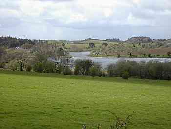
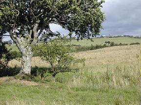
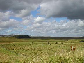
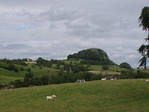
Rising up from the surrounding farmland, the volcanic remains of Loudoun Hill (NS 609 79) provide an impressive landmark at the eastern end of the Irvine Valley. It was in the shadow of this hill in 1297 that William Wallace and his men ambushed an English baggage train bound for Ayr and later in 1307 that Robert The Bruce fought a decisive battle in his struggle for Scottish independence. Today the hill is the haunt of rock climbers, picnickers and the odd birder or two. The site is just off the A71 Strathaven road, about miles east of Darvel. There is a public car park at NS 613 78 which can be reached by turning left onto the unclassified road immediately after the entrance to the gravel quarry in front of the hill. Follow this road up towards Drumboy Farm, the car park is on the left halfway up. From the car park there is a footpath which leads down to the valley of the River Irvine and the base of Loudoun Hill itself. An alternative approach to the hill can be made by parking in the car park at the Loudoun Hill Inn (NS 596 74), crossing the A71 and following the unclassified road directly opposite. This takes you up past Newlands Farm to the western face of the hill. There is a sign-posted Right of Way here which leads up the hill and provides the easiest route to the summit.
Access to Loudoun Hill by public transport is possible (though not easy) by bus. The No. 42 service run by Henderson Coaches, from Darvel to Hamilton passes by the site five times a day: the journey takes about twenty minutes. The return journey is slightly problematic as you have to catch one of these buses on the way back – the easiest place would be outside Loudoun Hill Inn. Further details can be obtained from The Travel Centre on 0870 608 2608. To get to Darvel you need to catch the No. 1 Stagecoach Service from Kilmarnock bus station which leaves every half hour. The site is within easy cycling distance of Darvel, but be warned – the A71 is a very busy road!

Unsurfaced car park, loose surface in places. Scan crags from car park.

Access along the A71 is not recommended. Instead, approach via byways to the north.

Birds

Good views of the crags on the south and east faces of the hill can be had from the car park mentioned above, displaying Peregrine and Raven can easily be seen from here at the start of the breeding season, Buzzard and Kestrel also frequent the slopes of the hill. For energetic birders the fields, hedges and braes along the River Irvine at the base of the hill are well worth exploring. In spring and summer the birds found there include Lapwing, Curlew, Meadow Pipit, Garden Warbler, Blackcap, Whitethroat, Pied Wagtail, Wheatear, Goldfinch and Yellowhammer. On the river itself Dipper and Grey Wagtail can be seen. The scattering of mature trees around the lower parts of the hill are good for Tits and Finches, Spotted Flycatcher, Chiffchaff and Willow Warbler. The summit of the hill is worth exploring at any time of the year, (on a clear day the views over Ayrshire, Lanarkshire and the Firth of Clyde are spectacular), but a visit in April could provide a good chance of finding spring migrants as the hill provides a handy stopping off point for arriving birds. Migrating Ring Ouzel have been recorded here in recent years. In winter the surrounding fields often hold very large numbers of Fieldfare, Redwing and other northern species and sometimes flocks of Greylag and other geese.

Other Information

There is an extensive and well sign-posted network of footpaths in the Irvine Valley area and Loudoun Hill is one of the key access points. A large notice board next to the car park has details of the routes on it and leaflets are available free of charge from a number of local information points such as the Town House in Darvel’s Main Street, or visit the Ayrshire Paths website. As well as giving you a perfect opportunity for wildlife observation, many of these footpaths also take in sites of historical interest like the museum at Barr Castle, the 15th Century Loudoun Kirk and the scenic viewpoint of Gallow Law Cairn. A day exploring the area would be well spent and there’s a good chance of notching up a healthy bird list along the way. If climbing the hill gives you a bit of an appetite, a good selection of bar meals can be had at the Loudoun Hill Inn mentioned above, and the Balmoral Knitwear Coffee Shop in Church Lane in nearby Galston has good coffee and a vast array of cakes for birders (and other folk) with a sweet tooth!
Kay Park and Townholm, Kilmarnock

Location and Access Details

These two adjacent sites are just five to ten minutes walk from Kilmarnock town centre. On foot, the Kay Park, OS grid reference NS 434 83, can be reached from the town centre by taking the road running down behind Henderson Church opposite the pub now known as The Saltire on London Road or from De Walden Terrace at Kilmarnock College. Parking is available by the pond off the B7082. Townholm (NS 433 87) can be accessed on foot from: the Kay Park at Strawberry Bank, South Dean Road in New Farm Loch, at the ford on Dean Lane, and off Beansburn. By car, take the turning off the B7082 and park by the five-a-side football complex.

Car park at Kay Park. Metalled paths, flat near pond, steeper near monument.

Easy ride from the town centre, bus & rail stations, and National Cycle Route N73.

Habitat

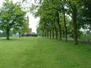
Kay Park and Townholm, along with Dean Country Park, form a band of green space running between the town centre and the countryside to the north of the town. The 0 acre park, with its monument to Robert Burns, is largely manicured, recreational parkland. Most interest occurs along the Kilmarnock Water. This area contrasts with Townholm which, with a more left to nature appearance, is comprised of rough grassland, wasteland, scrub and a small area of mixed woodland. There is little evidence that a housing scheme once stood here. The habitat difference is reflected in the species lists for the two sites.

Birdwatching, Timing and Points of Interest

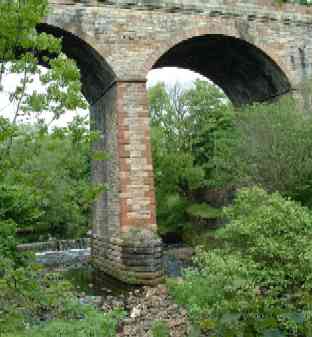
The Kay Park supports breeding Dipper, Grey Wagtail and Spotted Flycatcher among the typical parkland species. The best viewpoint of the river is by the weir at the viaduct on the park side, however, much of the town side of the river provides the best visibility. Bullfinch can often be found in the bushes by the tennis courts (NS 432 82) and Siskin in the alders by the viaduct. In recent years the pond (NS 435 83) has become more interesting (perhaps due to the lack of boating activity) with breeding Coot, Moorhen and Mute Swan. Grey Heron and Cormorant are often present, particularly in winter. The recent autumn and winter (2001/2002) saw, surprisingly, up to a dozen Goosander at times and were probably part of the daily movements of birds between the River Irvine and North Craig Reservoir. Additionally, nesting Herring and Lesser Black-backed Gulls can be observed on the roofs of Kilmarnock College buildings.
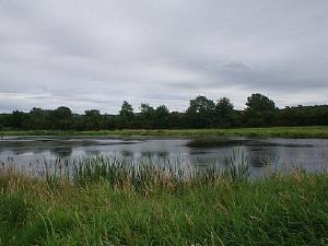
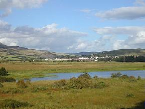
Townholm is of greater interest and wildlife value with breeding Blackcap, Garden Warbler, Willow Warbler, Whitethroat, Sedge Warbler, Dipper, Grey Wagtail, Spotted Flycatcher and five species of finch. Kingfisher puts in an appearance during the autumn and winter and sitting patiently by the pipe (NS 433 89) or the footbridge (NS 432 89) can sometimes be rewarding. Bullfinch can be observed regularly in riverside scrub at (NS 436 89). Small flocks of Siskin occasionally occur in winter in the small stand of alders here. Most of the occasional or locally scarce species mentioned in the list below have occurred at this site.

Species Calendar

All Year
Many of the breeding residents, Cormorant, Grey Heron, Black-headed Gull.
Spring
Sand Martin, Swallow, House Martin, Chiffchaff.
Breeding
Mute Swan, Mallard, Sparrowhawk, Moorhen, Coot, Herring Gull, Lesser Black-backed Gull, Feral Pigeon, Wood Pigeon, Tawny Owl, Swift, Pied Wagtail, Grey Wagtail, Wren, Dipper, Dunnock, Robin, Song Thrush, Mistle Thrush, Blackbird, Garden Warbler, Blackcap, Whitethroat, Sedge Warbler, Willow Warbler, Goldcrest, Spotted Flycatcher, Great Tit, Blue Tit, Coal Tit, Long-tailed Tit, Treecreeper, Magpie, Carrion Crow, Jackdaw, Starling, House Sparrow, Chaffinch, Linnet, Goldfinch, Greenfinch, Bullfinch.
Autumn and Winter
Common Gull, Kingfisher, Great Spotted Woodpecker, Redwing, Fieldfare, Rook, Siskin.
Occasional or locally scarce species
Little Grebe, Goosander, Buzzard, Peregrine, Kestrel, Woodcock, Snipe, Stock Dove, Cuckoo, Skylark, Meadow Pipit, Stonechat, Grasshopper Warbler, Jay, Brambling, Redpoll, Reed Bunting.

Other Information

Dipper, Grey Wagtail and Grey Heron can be observed on the Kilmarnock Water from several points within the town centre e.g. Palace Theatre/Grand Hall (NS 429 79), Cheapside Street (NS 427 78), St. Marnock Street (NS 427 77) and in the Howard Park (NS 426 74). Kingfisher is occasional.

East Holmes Marsh and Ladyton Loch

Location and Access

Both of these sites lie about a mile to the west of Galston, one of three towns built along the valley of the River Irvine in the north-east corner of East Ayrshire.

East Holmes Marsh (also known as the Grougar Marshes) lies between the River Irvine and the Cessnock Water at NS 473 72. Access is possible by parking at Hoodston Bridge, (NS 471 69), just off the busy A71 about 1km from Hurlford / 2km from Galston. You can scan most of the marsh and the surrounding area, (which floods whenever it rains heavily), by scope from the small car park or you can get closer to the marsh by carefully crossing the road, turning right and walking up the verge for about 200m to where a narrow track leads down through the fields. This track runs along the eastern edge of the marsh and offers good vantage points and plenty of cover. Reasonable viewing can also be had on the opposite side from the small track which follows the bank of the Cessnock.

Ladyton or Lady Loch is found on the north side of the River Irvine at NS 486 73. It can be reached by following the unclassified road which is opposite the entrance to Loudoun Castle Theme Park on the A719, to the north of Galston. The loch is on the left hand side just past the Ladyton Farm roadend, the road here is very narrow so please park carefully. It is also worth noting that unless you are the owner of a large 4 wheel drive or a tractor you should turn around at the loch and go back the way you came – once the tarmac runs out at the farm the road gets very rough! Alternatively you can park in Galston town centre and follow the public Right of Way from the underpass at NS 499 71, up the old “coffin road” past the churchyard and onto the unclassified road mentioned above.

There are a number of bus services from Kilmarnock which run past Hoodston Bridge into Galston at least every half hour. Contact Kilmarnock bus station on 01563 525192 for details.

East Holmes Marsh: Car park on trunk road with fast traffic. Scan from CP with telescope. Fence prevents access to track. Ladyton Loch: View from car at side of road. Road rough and unsurfaced in places.

Access to marsh along A71 is not recommended. Ladyton Loch is accessible along quiet byway.

Birds

East Holmes is particularly good for waders on passage in the spring and autumn – Snipe, Redshank, Common Sandpiper, Curlew and Oystercatcher are all regular visitors. Other less common birds such as Green and Wood Sandpiper, Little Egret and Ruff have also put in appearances in recent times. Breeding birds at the site include Grey Heron, Water Rail, Grasshopper Warbler, Reed Bunting and Little Grebe. In winter the marsh holds a good range of ducks: Teal, Mallard, Wigeon, Pochard, Gadwall and Tufted Duck can all be seen.

Ladyton Loch is quite small but is worth a visit if you are in the area. Little Grebe, Mute Swan, Moorhen, Teal and Mallard breed on the site and there are always Whooper Swans and other wildfowl in the winter. The surrounding marshy fields, scrub woodland and hedgerows are also good for birds Breeding species include Lapwing, Grey Heron, Oystercatcher, Bullfinch, Reed Bunting, Yellowhammer and Sedge Warbler. The Ravens from nearby Loudoun Hill have also been seen on the track beside the loch!

This stretch of the River Irvine has a Sand Martin colony and breeding Dipper. Kingfisher can also be seen.

Bogton Loch, Dalmellington

Location and Access

The loch and contiguous wetlands lie close to the west of Dalmellington on the A713 Ayr-Castle Douglas road. There are a number of informal footpaths around the site and it is reasonably easy to access on foot from Dalmellington which is on a regular bus route from Ayr. Excellent viewing is had from the west bank. This is reached by following the B741 from Dalmellington to Straiton and then, within 1km, over a hump-backed bridge, going left along a byway towards Dalcairney Farm. There is one modest layby for parking (NS 465 055) and turning a car and a few places where a vehicle may ease onto the verge of the narrow road. Please park with consideration for other users.

These are narrow country roads with no surfaced lay-bys or safe refuges for wheelchair users to avoid passing traffic. Limited opportunities to view from car. One surfaced lay-by at south end of loch on Dalcairney farm road reasonable view of loch.

Easy cycle ride from Dalmellington.

Birds

This site is a Site of Special Scientific Interest with reedbeds and wetlands around the loch. It is excellent for wetland breeding species and wintering birds. Whooper Swan and Greylag Goose are present in good numbers in winter and Bittern has been recorded. Flocks of finch including Brambling can be found along the beech-lined road. Mallard, Teal, Goldeneye and Dabchick are likely sightings and Shoveler on occasion. Water Rail, Snipe, Whinchat, Grasshopperand Sedge Warbler and Reed Bunting are present and Willow Tit have been observed in the scrub around the road end. Raptors seen include Kestrel, Peregrine, Sparrowhawk and Hen Harrier. Otters can be seen feeding and playing.

Martnaham

Location and Access

A large inland loch (2km in length) found two kilometres south of Coylton. Take the B742 from Coylton and turn off left at NS 402 183 for the south side or continue along the B742 and take first left after the Jelliston turning and the manor house is beside the loch. This latter access point is private, though currently the owner does allow access if he is notified and all common courtesies are followed. There is access to the loch from the south with parking at two spots, firstly, at the road junction at NS 405 177, and secondly at the small lay-by at NS 403 173. From these two parking spots the southern side of the loch can be explored and viewed. A telescope is recommended.

These are narrow country roads with no surfaced laybys or safe refuges for wheelchair users to avoid passing traffic. Limited opportunities to view from car.

On good network of byways linking through to Ayr and Cumnock, but beware of opencast mining traffic near Cumnock.

Birds

Martnaham Loch holds SSSI status for the western half of its spread. The south-western end of the loch is bordered by mixed woodland which can be productive in the summer. Access is limited, so pay attention to sign-posting. It is a significant freshwater site for its size and orientation. Whilst its shape runs predominately south-west to north-east, there are enough inlets and bays to provide shelter from the wind coming from any direction. Maybe it is because of this that Martnaham boasts some notable rarities over the years, including more recently a returning long-staying male Smew, a Ring-necked Duck, Black Tern, Lesser Scaup and Hobby.

Autumn and winter see reasonable flocks of ducks, including Goldeneye, Wigeon, Pochard and Teal. There is also the chance of seeing Shoveler, Scaup, Long-tailed Duck and Gadwall. During stormy weather large flocks of gulls have been known to congregate, with rarer visitors such as Glaucous, Iceland and Mediterranean Gulls. Late winter can see reasonable flocks of Greylag Geese and Whooper Swans gathering in the nearby fields. An early start is recommended to see the geese before they leave the loch to feed in the surrounding area.

With lower water levels in autumn, passage waders can often be found at the eastern end. During migration keep an eye out for the raptors that follow the migrating birds. Great Crested and Little Grebe breed, while the latest birds to start breeding include Canada Geese in 2000.

The loch is also good for passage birds: Oystercatcher, Curlew, Redshank, Common Sandpiper, Whimbrel, Ruff, Green Sandpiper, Black-tailed Godwit, Wheatear and Whinchat. Large numbers of hirundines also use the loch to feed and roost at this time.

The article That Redhead’s No Lady by Dave Grant describes the moulting of a Martnaham Smew. This originally appeared in Ayrshire Bird Report 2001.

Other Information

Whilst in the locality, the smaller Fergus Loch (NS 9 18) and Snipe Loch (NS 8 17) should also be checked for interest. The fields surrounding the former loch have been a favourite haunt of Whooper Swans in past years, with flocks of 0+ birds in late autumn.

Cumnock Byways and Glenmuir

Location and Access

From the township of Logan (NS 59 20), just east of Cumnock off the A70, a 10-12km network of byways can be accessed which link the farms on the hills east of Cumnock with the A70 and A76 trunk routes. These quiet back roads, mainly single track, are ideal for birdwatching by bike but can be explored by car or on foot from Cumnock or Logan, both well served by buses. Please park with due consideration for other road users and farmers needing access to fields.

Surfaced minor roads. Be alert for passing vehicles. Scan from car.

Many quiet roads to explore.

Birds

The byways pass through diverse habitat. The high ground is largely developed and undeveloped pastureland but there is also a large area of moss between the crossing of Glenmuir Water and the A70. Many sections of road are bordered by mature stands of beech and other broadleaved trees and there are several patches of mixed woodland. The roads pass by or close to a number of working farms. Glenmuir is a narrow gorge, well foliated, with scrub, woodland and open ground. The whole area is on a migration flight path. The area is good for Fieldfare and Redwing in winter, and flocks of finches, though anything is possible on passage. Depending on the season, warblers, tits, Spotted Flycatcher, Common Whitethroat and other woodland and hedgerow birds are likely and the farms attract Swallow especially. Kestrel is a common raptor.

Airds Moss

Location and Access

This large tract of upland moor (NS 61 25) is an important ornithological site lying to the south of the upper reaches of the River Ayr. It is bounded by the A70 Cumnock-Muirkirk trunk road on the south and and the B743 on the north.

It is possible to get into the Moss on foot from Auchinleck, Cumnock, Cronberry and Muirkirk, all of which are on regular bus routes and there are plans for a footpath in the north-eastern section beside the River Ayr. Some of the byways can be explored, with care, by cycle and there are one or two spots which can be easily investigated on foot.
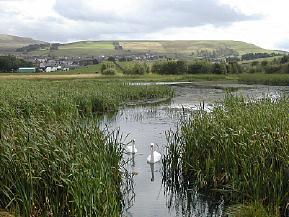
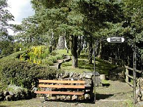
Essentially, however, viewing is from one of the major or minor roads around the site. A large layby to the north east of Cronberry on the A70 provides a strategic overview and the byway into the Moss just south east of Cronberry has good vantage points. A short distance along this road (on the left as you head towards Auchinleck), is Common Loch (NS 59 22). This small loch holds a good variety of breeding and wintering birds and is worth checking out at any time of the year. Attention should also be paid to the surrounding area of scrub woodland – a Great Grey Shrike turned up at nearby Commondyke Farm (NS 578 225) a couple of winters ago. Please be alert to the opencast coal mining traffic in the vicinity. A number of wayside stops can be found on the B743 Sorn-Muirkirk road with good birding on both sides, e.g. the bridge over the Greenock Water at NS 631 272.

Park and scan from vehicle.

The A70 requires great care. Some byways also carry mining traffic.

Birds

There are many interesting moorland species breeding here including Hen Harrier, Merlin, Red Grouse, Golden Plover, Dunlin and Curlew. Peregrine have been seen and good numbers of Short-eared Owl when the vole numbers are strong. Black Grouse have been observed close to the Sorn-Muirkirk road. Skylark, Tree Pipit, Lesser Redpoll, Stonechat, Whinchat, Wheatear, Common Crossbill, Mistle Thrush, and Reed Bunting are among the other species which are likely to be encountered during a summer visit to the area. In winter, there are always large flocks of thrushes and plenty of ducks and swans to be seen on the small lochs.

Conservation Issues

The area has opencast coal mining potential which gives rise to conflicts of interest between commercial and ecological considerations. Hopefully, compromise and agreement will preserve the moss as a major ornithological site in East Ayrshire.

Knockshinnoch Lagoons

Location and Access

The area comprises three lochs: Black Loch, Creoch Loch and Loch o’ th’ Lowes – along with extensive water meadows on the floodplain of the upper River Nith to the east of New Cumnock and, to the west, mining subsidence lagoons fringed by reedbeds and a small area of heather moorland (Yellow Moss).

The former mining area, the Knockshinnoch Lagoons, is predominantly a Scottish Wildlife Trust reserve and can be easily accessed by walking up Castlehill lane past the cemetry, following the Community Pathway signs to Knockshinnoch from a large free car park on the opposite (east) side of the main street of New Cumnock at NS 617 138, or from a small SWT car park just to the south on the B741 at NS 614 132. New Cumnock is served by buses along the A76 and trains on the Kilmarnock-Carlisle line.

The Lochside House Hotel (NS 602 148) whose drive leads off the busy A76 1.5km north-west of New Cumnock provides civilised viewing across Loch o’ th’ Lowes from its bar lounge, open to non-residents. Other parts of the wetlands can be accessed with care and consideration and an excellent overview of the eastern flood plain is had from the Craigdullyeart Hill byway.

More information is available on the Scottish Wildlife Trust’s web site.

Locked gate and stile from Castlehill Lane, further details to be posted here in due course.

Short ride from rail station to the Lagoons. Quiet along Craigdullyeart byways. A76 requires great care.

Update on May 2004

The railway embankment from the Boig road has been reinstated as a rail line and is therefore no longer an access option. The reserve can be viewed from the Boig road, from a nearby tree covered mound (NS 603131) or by walking into the fields adjacent to the rail line.

Access to the restored bing and pools remains straight forward although parking in the area of the old church (NS617138) is being discouraged.

Mike Howes, 6 May 2004

Update on September 2003

The railway police and officials from the coal washing plant are threatening prosecution for anyone caught walking on the railway dividing the western half of the reserve from the restored bing. Even crossing the tracks is forbidden and cameras are apparently being used for back up evidence. There is no alternative if you wish to access the western pools but to drive around to the Boig road (1 km south west of New Cumnock at Connel Park) and park sensibly in the vicinity of Woodend Farm (NS598135). From here you can follow the old railway embankment to view the area.

Mike Howes, 25 Sep 2003

Birds

Apart from the wide variety of breeding waterfowl and waders, the location holds breeding Water Rail, Whinchat, Grasshopper Warbler, Sedge Warbler and Reed Bunting. Both Garganey and Spotted Crake have occurred in the spring, the former breeding on one occasion. A flight-line for migrants occurs along the Nith Valley and is regularly taken by birds heading to or from the Solway. Most obvious are flocks of Greylag, Pink-footed and Barnacle Geese, along with Whooper Swan, some of which winter on the water meadows at Polquhirter. Autumn is perhaps best for migrant waders such as Black-tailed Godwit, Ruff and Greenshank with the outside chance of something rarer. For example, Wilson's Phalarope has occurred.

Community Path Network

A number of paths through the countryside around New Cumnock have been sign posted. These cover diverse habitat, including the Lagoons, and could be worth exploring, especially during the passage seasons.

Glen Afton

Location and Access

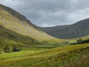
In New Cumnock where the A76 takes a dog-leg take the B741 to Dalmellington and then very soon after take the road on the left down into Glen Afton. Robert Burns worked as a shepherd in this glen in the 1780s and the commemorative Burns Cairn is 2km down the road. He was also a decent birder:

Flow gently, sweet Afton, among thy green braes!
Flow gently, I’ll sing thee a song in thy praise!
My Mary’s asleep by thy murmuring stream –
Flow gently, sweet Afton, disturb not her dream!
Thou stock dove whose echo resounds thro the glen,
Ye wild whistling blackbirds in yon thorny den,
Thou green-crested lapwing, thy screaming forbear –
I charge you, disturb not my slumbering Fair.

The Glen is still beautiful and good for birds today. It comprises some 8km of upland river valley with scattered broadleaf woodland and conifer plantation. Park at the monument or at the reservoir at the head of the glen (taking care to observe access restrictions) and explore the glen on foot or by bike along the byway. New Cumnock is served by buses along A76 and trains on the Kilmarnock-Carlisle line.

Quite country road but be alert for occasional traffic, several places to park, most of valley can be traversed by wheelchair up to base of dam. Recent rumour of locked gate at cottages.

Easy ride from New Cumnock.

Birds

The glen is good for summer migrants, especially at the lower end where the trees are denser, including Whitethroat, Willow and Sedge Warbler, Redstart and Tree Pipit. Also present are Garden and Wood Warbler, Blackcap, Pied Flycatcher and Crossbill. Dipper, Common Sandpiper and Grey Wagtail frequent the burn and Buzzard breed well in the area.
Pathways

There is a long tradition of public access here and it is easy to get to the reservoir and onto the surrounding uplands. There are plans to upgrade existing footpaths and to create a new circular cycle route around the reservoir. A public right of way runs through the forest and there is informal access to forest tracks.

Blackcraig Hill

Location and Access

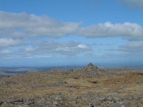
Blackcraig Hill, at 700m, is one of a number of energetic but technically easy hill walks in the vicinity of New Cumnock. One route onto the hill is to park 6km up the Glen Afton byway which leaves B741 just outside New Cumnock and follow the public footpath which leads past Blackcraig Farm house and over the north shoulder of the hill. Parking is limited beside the burn at the start of the path . Please park considerately. The summit of Blackcraig is characterised by broken rock and scree more reminiscent of the higher plateaux found in the Cairngorms.

The nearest public transport, bus and train, is at New Cumnock, a long walk but an easy cycle ride distance along the Glen Afton byway.

<Off-road tracks unsuitable for wheelchair users.

Easy ride from New Cumnock to the start: hill track would be fun!

Birds

Typical moorland birds can be seen and Peregrine is a real possibility but the plateau of Blackcraig Hill has become particularly well known as a good spot for Dotterel in early May. Luck and weather are major factors but this area is one of the attractive rest-ups for these migrants on passage. Golden Plover and Dunlin breed on the summit plateau Meadow Pipit are ubiquitous. Wheatear frequent the posts and rocky outcrops. In early winter flocks of Snow Bunting have been seen on the summit plateau.

Raptors include Buzzard, Kestrel, Merlin, Hen Harrier and Short- eared Owl – a hot day could yield other raptors riding on thermals, easily seen when scanning the skyline from the head of the valley.